Ḩajar al Mashā’ikh geodata
Ḩajar al Mashā’ikh (Ḩaḑramawt) is a seat of a second-order administrative division; located in Yemen in Asia/Aden (GMT+3) time zone. In our database, there are 51 cities with bigger population. Compared to other cities in Yemen, 85.4% of cities are located further ↓South; 87.3% of cities are located further ←West and 57.8% of cities have higher elevation than Ḩajar al Mashā’ikh. Note1


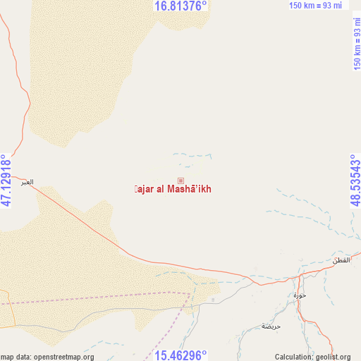
Ḩajar al Mashā’ikh GPS coordinates[2]
16° 8' 22.236" North, 47° 49' 56.28" East
| Map corner | latitude | longitude |
|---|---|---|
| Upper-left | 16.81376°, | 47.12918° |
| Center: | 16.13951°, | 47.8323° |
| Lower-right: | 15.46296°, | 48.53543° |
| Map W x H: | 150.2×150.2 km | = 93.3×93.3mi |
| max Lat: | 17.76999° ⇑14.6% North |
| Ḩajar al Mashā’ikh: | 16.13951° |
| min Lat: | ⇓85.4% South 12.18576° |
| min Long | Ḩajar al Mash | max Long |
| 42.67107° | 47.8323° | 54.01895° |
| W 87.3%⇐ | ⇒12.7% E |
Elevation
Elevation of Ḩajar al Mashā’ikh is 1193 m = 3914 ft, and this is 111.8 m = 367 ft below average elevation for this country.
| Max E: |
2791 m = 9157 ft | 57.8% |
| Avg. | 1304.8 m = 4281 ft | |
| Ḩajar al Mashā’ikh | 1193 m = 3914 ft | |
Min E: |
4 m = 13 ft | 42.2% |
See also: Yemen elevation on elevation.city.
Geographical zone
Ḩajar al Mashā’ikh is located in North Torrid zone (between Equator and Tropic of Cancer). Distance of this Northern Tropic circle is 811.4 km =504.2 mi to North.| Distance of | km | miles | from Ḩajar al Mashā’ikh |
|---|---|---|---|
| North Pole | 8212.5 | 5103 | to North |
| Arctic Circle | 5606.6 | 3483.8 | to North |
| Tropic Cancer | 811.4 | 504.2 | to North |
| Equator | 1794.5 | 1115.1 | to South |


Nearby cities:
15 places around Ḩajar al Mashā’ikh: (largest is in red/bold)
• Al Bāţinah
97.3 km =60.5 mi,  138°
138°
• Al Qaţan
74.5 km =46.3 mi,  116°
116°
• Al Ḩamdī
103.5 km =64.3 mi,  101°
101°
• Al ‘Abr
63.7 km =39.6 mi,  269°
269°
• Al ‘Ummāl
105.9 km =65.8 mi, 101°
• At Taḩāluf
104.4 km =64.9 mi, 102°
• Ath Thawrah
104.8 km =65.1 mi, 101°
• Bāḩashawān
104.2 km =64.7 mi, 102°
• Maţarah
71.5 km =44.4 mi,  197°
197°
• Minwakh
79.2 km =49.2 mi,  21°
21°
• Suḩayl Shibām
89.7 km =55.7 mi,  106°
106°
• Şanā’
82.5 km =51.3 mi,  184°
184°
• Şīf
106.1 km =65.9 mi,  149°
149°
• Ḩurayḑah
70.9 km =44.1 mi, 148°
• ‘Amd
94.7 km =58.8 mi,  170°
170°
Sources, notices
• [Note1] Compared only with cities in Yemen existing in our database
• [Src1] Map data: © OpenStreetMap contributors (CC-BY-SA)
• [Src2] Other city data from geonames.org with taken over terms of usage.
• [Src3] Geographical zone / Annual Mean Temperature by Robert A. Rohde @ Wikipedia
