Ḩurayḑah geodata
Ḩurayḑah (Ḩaḑramawt) is a seat of a second-order administrative division; located in Yemen in Asia/Aden (GMT+3) time zone. In our database, there are 51 cities with bigger population. Compared to other cities in Yemen, 69.5% of cities are located further ↓South; 88.6% of cities are located further ←West and 70.1% of cities have higher elevation than Ḩurayḑah. Note1


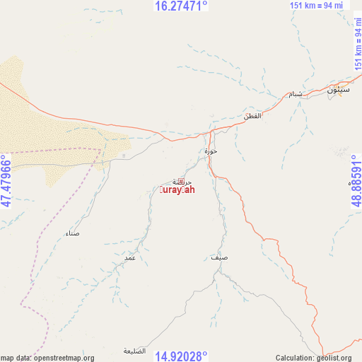
Ḩurayḑah GPS coordinates[2]
15° 35' 54.996" North, 48° 10' 58.008" East
| Map corner | latitude | longitude |
|---|---|---|
| Upper-left | 16.27471°, | 47.47966° |
| Center: | 15.59861°, | 48.18278° |
| Lower-right: | 14.92028°, | 48.88591° |
| Map W x H: | 150.6×150.6 km | = 93.6×93.6mi |
| max Lat: | 17.76999° ⇑30.5% North |
| Ḩurayḑah: | 15.59861° |
| min Lat: | ⇓69.5% South 12.18576° |
| min Long | Ḩurayḑah | max Long |
| 42.67107° | 48.18278° | 54.01895° |
| W 88.6%⇐ | ⇒11.4% E |
Elevation
Elevation of Ḩurayḑah is 838 m = 2749 ft, and this is 466.8 m = 1531 ft below average elevation for this country.
| Max E: |
2791 m = 9157 ft | 70.1% |
| Avg. | 1304.8 m = 4281 ft | |
| Ḩurayḑah | 838 m = 2749 ft | |
Min E: |
4 m = 13 ft | 29.9% |
See also: Yemen elevation on elevation.city.
Geographical zone
Ḩurayḑah is located in North Torrid zone (between Equator and Tropic of Cancer). Distance of this Northern Tropic circle is 871.5 km =541.5 mi to North.| Distance of | km | miles | from Ḩurayḑah |
|---|---|---|---|
| North Pole | 8272.7 | 5140.4 | to North |
| Arctic Circle | 5666.8 | 3521.2 | to North |
| Tropic Cancer | 871.5 | 541.5 | to North |
| Equator | 1734.4 | 1077.7 | to South |


Nearby cities:
15 places around Ḩurayḑah: (largest is in red/bold)
• Al Bāţinah
29.7 km =18.5 mi,  115°
115°
• Al Qaţan
39.7 km =24.7 mi,  47°
47°
• Al Ḩamdī
74.7 km =46.4 mi,  58°
58°
• Al ‘Ummāl
76.8 km =47.7 mi, 59°
• At Taḩāluf
74.8 km =46.5 mi, 59°
• Ath Thawrah
75.7 km =47 mi, 59°
• Az̧ Z̧alī‘ah
67.1 km =41.7 mi,  195°
195°
• Bāḩashawān
75 km =46.6 mi, 59°
• Maţarah
59.4 km =36.9 mi,  262°
262°
• Suḩayl Shibām
60.1 km =37.3 mi, 54°
• Sāh
71.6 km =44.5 mi,  91°
91°
• Şanā’
49.8 km =30.9 mi,  243°
243°
• Şīf
35.4 km =22 mi,  153°
153°
• Ḩajar al Mashā’ikh
70.9 km =44.1 mi,  328°
328°
• ‘Amd
39.5 km =24.5 mi,  212°
212°
Sources, notices
• [Note1] Compared only with cities in Yemen existing in our database
• [Src1] Map data: © OpenStreetMap contributors (CC-BY-SA)
• [Src2] Other city data from geonames.org with taken over terms of usage.
• [Src3] Geographical zone / Annual Mean Temperature by Robert A. Rohde @ Wikipedia
