Şīf geodata
Şīf (Ḩaḑramawt) is a seat of a second-order administrative division; located in Yemen in Asia/Aden (GMT+3) time zone. In our database, there are 51 cities with bigger population. Compared to other cities in Yemen, 59.1% of cities are located further ↓South; 89.3% of cities are located further ←West and 65.6% of cities have higher elevation than Şīf. Note1


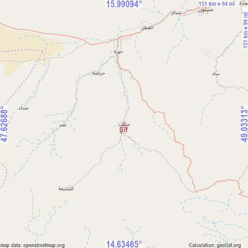
Şīf GPS coordinates[2]
15° 18' 50.004" North, 48° 19' 48" East
| Map corner | latitude | longitude |
|---|---|---|
| Upper-left | 15.99094°, | 47.62688° |
| Center: | 15.31389°, | 48.33° |
| Lower-right: | 14.63465°, | 49.03313° |
| Map W x H: | 150.8×150.8 km | = 93.7×93.7mi |
| max Lat: | 17.76999° ⇑40.9% North |
| Şīf: | 15.31389° |
| min Lat: | ⇓59.1% South 12.18576° |
| min Long | Şīf | max Long |
| 42.67107° | 48.33° | 54.01895° |
| W 89.3%⇐ | ⇒10.7% E |
Elevation
Elevation of Şīf is 1009 m = 3310 ft, and this is 295.8 m = 970 ft below average elevation for this country.
| Max E: |
2791 m = 9157 ft | 65.6% |
| Avg. | 1304.8 m = 4281 ft | |
| Şīf | 1009 m = 3310 ft | |
Min E: |
4 m = 13 ft | 34.4% |
See also: Yemen elevation on elevation.city.
Geographical zone
Şīf is located in North Torrid zone (between Equator and Tropic of Cancer). Distance of this Northern Tropic circle is 903.2 km =561.2 mi to North.| Distance of | km | miles | from Şīf |
|---|---|---|---|
| North Pole | 8304.3 | 5160.1 | to North |
| Arctic Circle | 5698.4 | 3540.8 | to North |
| Tropic Cancer | 903.2 | 561.2 | to North |
| Equator | 1702.7 | 1058 | to South |


Nearby cities:
15 places around Şīf: (largest is in red/bold)
• Al Bāţinah
21.9 km =13.6 mi,  30°
30°
• Al Qaţan
60.1 km =37.3 mi,  12°
12°
• Al Ḩamdī
85.3 km =53 mi, 34°
• Al ‘Ulayb
81.9 km =50.9 mi,  103°
103°
• Al ‘Ummāl
86.7 km =53.9 mi,  35°
35°
• At Taḩāluf
84.9 km =52.8 mi, 35°
• Ath Thawrah
85.9 km =53.4 mi, 35°
• Az̧ Z̧alī‘ah
47.1 km =29.3 mi,  225°
225°
• Bāḩashawān
85.3 km =53 mi, 34°
• Maţarah
78.3 km =48.7 mi,  287°
287°
• Suḩayl Shibām
74.5 km =46.3 mi, 26°
• Sāh
63 km =39.1 mi,  62°
62°
• Şanā’
61.2 km =38 mi,  279°
279°
• Ḩurayḑah
35.4 km =22 mi,  333°
333°
• ‘Amd
37.2 km =23.1 mi,  267°
267°
Sources, notices
• [Note1] Compared only with cities in Yemen existing in our database
• [Src1] Map data: © OpenStreetMap contributors (CC-BY-SA)
• [Src2] Other city data from geonames.org with taken over terms of usage.
• [Src3] Geographical zone / Annual Mean Temperature by Robert A. Rohde @ Wikipedia
