Al Jabīn geodata
Al Jabīn (Raymah) is a seat of a first-order administrative division; located in Yemen in Asia/Aden (GMT+3) time zone. In our database, there are 51 cities with bigger population. Compared to other cities in Yemen, 54.2% of cities are located further ↑North; 80.2% of cities are located further →East and 93.8% of cities have lower elevation than Al Jabīn. Note1


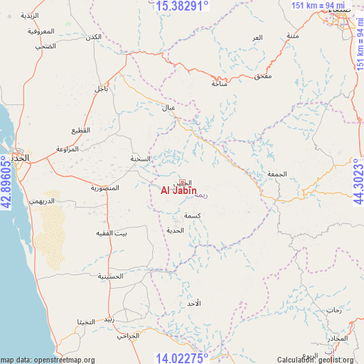
Al Jabīn GPS coordinates[2]
14° 42' 14.004" North, 43° 35' 57.012" East
| Map corner | latitude | longitude |
|---|---|---|
| Upper-left | 15.38291°, | 42.89605° |
| Center: | 14.70389°, | 43.59917° |
| Lower-right: | 14.02275°, | 44.3023° |
| Map W x H: | 151.2×151.2 km | = 94×94mi |
| max Lat: | 17.76999° ⇑54.2% North |
| Al Jabīn: | 14.70389° |
| min Lat: | ⇓45.8% South 12.18576° |
| min Long | Al Jabīn | max Long |
| 42.67107° | 43.59917° | 54.01895° |
| W 19.8%⇐ | ⇒80.2% E |
Elevation
Elevation of Al Jabīn is 2427 m = 7963 ft, and this is 1122.2 m = 3682 ft above average elevation for this country.
| Max E: |
2791 m = 9157 ft | 6.2% |
| Al Jabīn | 2427 m 7963 ft | |
| Avg. | 1304.8 m = 4281 ft | |
Min E: |
4 m = 13 ft | 93.8% |
See also: Yemen elevation on elevation.city.
Geographical zone
Al Jabīn is located in North Torrid zone (between Equator and Tropic of Cancer). Distance of this Northern Tropic circle is 971 km =603.4 mi to North.| Distance of | km | miles | from Al Jabīn |
|---|---|---|---|
| North Pole | 8372.1 | 5202.2 | to North |
| Arctic Circle | 5766.3 | 3583 | to North |
| Tropic Cancer | 971 | 603.4 | to North |
| Equator | 1634.9 | 1015.9 | to South |


Nearby cities:
15 places around Al Jabīn: (largest is in red/bold)
• Ad Dann
47.7 km =29.6 mi,  145°
145°
• Al Jum‘ah
39.5 km =24.5 mi,  84°
84°
• Al Manşūrīyah
32.3 km =20.1 mi,  266°
266°
• Al Ḩadīyah
20 km =12.4 mi,  188°
188°
• Al-Medy Village, قرية المدي
39.5 km =24.5 mi, 148°
• As Sukhnah
20.2 km =12.6 mi,  299°
299°
• Aḑ Ḑil‘
23.8 km =14.8 mi,  98°
98°
• Bayt al Faqīh
36.2 km =22.5 mi,  234°
234°
• Kusmah
14.2 km =8.8 mi,  163°
163°
• Manākhah
43.9 km =27.3 mi,  20°
20°
• Markaz Bilād aţ Ţa‘ām
15.9 km =9.9 mi,  334°
334°
• Matwaḩ
40.7 km =25.3 mi,  6°
6°
• Riqāb
24.9 km =15.5 mi,  324°
324°
• Sūq ar Rubū‘
49.6 km =30.8 mi,  115°
115°
• ‘Ubāl
32.1 km =19.9 mi,  349°
349°
Sources, notices
• [Note1] Compared only with cities in Yemen existing in our database
• [Src1] Map data: © OpenStreetMap contributors (CC-BY-SA)
• [Src2] Other city data from geonames.org with taken over terms of usage.
• [Src3] Geographical zone / Annual Mean Temperature by Robert A. Rohde @ Wikipedia
