Riqāb geodata
Riqāb (Al Hudaydah) is a seat of a second-order administrative division; located in Yemen in Asia/Aden (GMT+3) time zone. In our database, there are 51 cities with bigger population. Compared to other cities in Yemen, 50.3% of cities are located further ↓South; 86% of cities are located further →East and 70.1% of cities have lower elevation than Riqāb. Note1


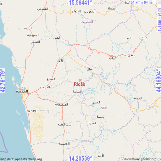
Riqāb GPS coordinates[2]
14° 53' 9.492" North, 43° 27' 53.676" East
| Map corner | latitude | longitude |
|---|---|---|
| Upper-left | 15.56441°, | 42.76179° |
| Center: | 14.88597°, | 43.46491° |
| Lower-right: | 14.20539°, | 44.16804° |
| Map W x H: | 151.1×151.1 km | = 93.9×93.9mi |
| max Lat: | 17.76999° ⇑49.7% North |
| Riqāb: | 14.88597° |
| min Lat: | ⇓50.3% South 12.18576° |
| min Long | Riqāb | max Long |
| 42.67107° | 43.46491° | 54.01895° |
| W 14%⇐ | ⇒86% E |
Elevation
Elevation of Riqāb is 1949 m = 6394 ft, and this is 644.2 m = 2114 ft above average elevation for this country.
| Max E: |
2791 m = 9157 ft | 29.9% |
| Riqāb | 1949 m 6394 ft | |
| Avg. | 1304.8 m = 4281 ft | |
Min E: |
4 m = 13 ft | 70.1% |
See also: Yemen elevation on elevation.city.
Geographical zone
Riqāb is located in North Torrid zone (between Equator and Tropic of Cancer). Distance of this Northern Tropic circle is 950.8 km =590.8 mi to North.| Distance of | km | miles | from Riqāb |
|---|---|---|---|
| North Pole | 8351.9 | 5189.6 | to North |
| Arctic Circle | 5746 | 3570.4 | to North |
| Tropic Cancer | 950.8 | 590.8 | to North |
| Equator | 1655.2 | 1028.5 | to South |


Nearby cities:
15 places around Riqāb: (largest is in red/bold)
• Ad Durayhimī
52 km =32.3 mi,  237°
237°
• Al Jabīn
24.9 km =15.5 mi,  144°
144°
• Al Khamīs
33.7 km =20.9 mi,  8°
8°
• Al Manşūrīyah
28.5 km =17.7 mi,  218°
218°
• Al Marāwi‘ah
34 km =21.1 mi,  259°
259°
• Al Ḩadīyah
41.6 km =25.8 mi,  164°
164°
• As Sukhnah
10.7 km =6.6 mi,  196°
196°
• Aḑ Ḑil‘
44.8 km =27.8 mi,  122°
122°
• Bayt al Faqīh
43.8 km =27.2 mi, 200°
• Bājil
27.1 km =16.8 mi,  315°
315°
• Kusmah
38.5 km =23.9 mi,  151°
151°
• Manākhah
36.3 km =22.6 mi,  54°
54°
• Markaz Bilād aţ Ţa‘ām
9.6 km =6 mi,  127°
127°
• Matwaḩ
27.8 km =17.3 mi,  43°
43°
• ‘Ubāl
14.2 km =8.8 mi, 36°
Sources, notices
• [Note1] Compared only with cities in Yemen existing in our database
• [Src1] Map data: © OpenStreetMap contributors (CC-BY-SA)
• [Src2] Other city data from geonames.org with taken over terms of usage.
• [Src3] Geographical zone / Annual Mean Temperature by Robert A. Rohde @ Wikipedia
