Shahārat al Ghīs geodata
Shahārat al Ghīs (Omran) is a seat of a second-order administrative division; located in Yemen in Asia/Aden (GMT+3) time zone. In our database, there are 51 cities with bigger population. Compared to other cities in Yemen, 87% of cities are located further ↓South; 76.6% of cities are located further →East and 96.4% of cities have lower elevation than Shahārat al Ghīs. Note1


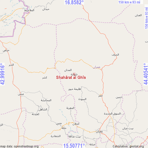
Shahārat al Ghīs GPS coordinates[2]
16° 11' 2.796" North, 43° 42' 8.208" East
| Map corner | latitude | longitude |
|---|---|---|
| Upper-left | 16.8582°, | 42.99916° |
| Center: | 16.18411°, | 43.70228° |
| Lower-right: | 15.50771°, | 44.40541° |
| Map W x H: | 150.2×150.2 km | = 93.3×93.3mi |
| max Lat: | 17.76999° ⇑13% North |
| Shahārat al Ghīs: | 16.18411° |
| min Lat: | ⇓87% South 12.18576° |
| min Long | Shahārat al Gh | max Long |
| 42.67107° | 43.70228° | 54.01895° |
| W 23.4%⇐ | ⇒76.6% E |
Elevation
Elevation of Shahārat al Ghīs is 2518 m = 8261 ft, and this is 1213.2 m = 3980 ft above average elevation for this country.
| Max E: |
2791 m = 9157 ft | 3.6% |
| Shahārat al Ghīs | 2518 m 8261 ft | |
| Avg. | 1304.8 m = 4281 ft | |
Min E: |
4 m = 13 ft | 96.4% |
See also: Yemen elevation on elevation.city.
Geographical zone
Shahārat al Ghīs is located in North Torrid zone (between Equator and Tropic of Cancer). Distance of this Northern Tropic circle is 806.4 km =501.1 mi to North.| Distance of | km | miles | from Shahārat al Ghīs |
|---|---|---|---|
| North Pole | 8207.6 | 5100 | to North |
| Arctic Circle | 5601.7 | 3480.7 | to North |
| Tropic Cancer | 806.4 | 501.1 | to North |
| Equator | 1799.5 | 1118.2 | to South |


Nearby cities:
15 places around Shahārat al Ghīs: (largest is in red/bold)
• Al Jamīmah
21.7 km =13.5 mi,  211°
211°
• Al Madān
7.7 km =4.8 mi,  305°
305°
• Al Maghrabah
34.3 km =21.3 mi,  186°
186°
• Al Maḩābishah
38.8 km =24.1 mi,  227°
227°
• Al Miftāḩ
34.5 km =21.4 mi, 227°
• Al Qaflah
16.6 km =10.3 mi,  25°
25°
• Al ‘Ashshah
18.2 km =11.3 mi,  63°
63°
• As Sūdah
26.4 km =16.4 mi,  161°
161°
• Khamir
34.6 km =21.5 mi,  129°
129°
• Khayrān
39 km =24.2 mi,  242°
242°
• Kushar
30.2 km =18.8 mi,  263°
263°
• Washḩah
34 km =21.1 mi,  293°
293°
• Şuwayr
9.9 km =6.2 mi,  268°
268°
• Ḩabūr
14.8 km =9.2 mi,  178°
178°
• Ḩūth
28.9 km =18 mi,  79°
79°
Sources, notices
• [Note1] Compared only with cities in Yemen existing in our database
• [Src1] Map data: © OpenStreetMap contributors (CC-BY-SA)
• [Src2] Other city data from geonames.org with taken over terms of usage.
• [Src3] Geographical zone / Annual Mean Temperature by Robert A. Rohde @ Wikipedia
