An Naz̧īr geodata
An Naz̧īr (Şa‘dah) is a seat of a second-order administrative division; located in Yemen in Asia/Aden (GMT+3) time zone. In our database, there are 51 cities with bigger population. Compared to other cities in Yemen, 96.4% of cities are located further ↓South; 94.2% of cities are located further →East and 65.3% of cities have lower elevation than An Naz̧īr. Note1


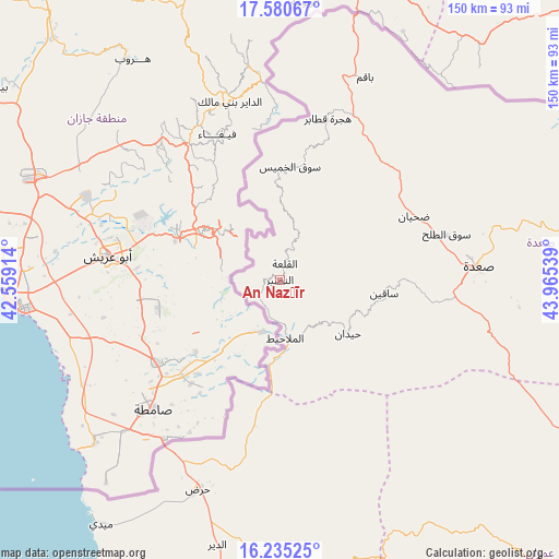
An Naz̧īr GPS coordinates[2]
16° 54' 32.976" North, 43° 15' 44.136" East
| Map corner | latitude | longitude |
|---|---|---|
| Upper-left | 17.58067°, | 42.55914° |
| Center: | 16.90916°, | 43.26226° |
| Lower-right: | 16.23525°, | 43.96539° |
| Map W x H: | 149.6×149.6 km | = 93×93mi |
| max Lat: | 17.76999° ⇑3.6% North |
| An Naz̧īr: | 16.90916° |
| min Lat: | ⇓96.4% South 12.18576° |
| min Long | An Naz̧īr | max Long |
| 42.67107° | 43.26226° | 54.01895° |
| W 5.8%⇐ | ⇒94.2% E |
Elevation
Elevation of An Naz̧īr is 1782 m = 5846 ft, and this is 477.2 m = 1566 ft above average elevation for this country.
| Max E: |
2791 m = 9157 ft | 34.7% |
| An Naz̧īr | 1782 m 5846 ft | |
| Avg. | 1304.8 m = 4281 ft | |
Min E: |
4 m = 13 ft | 65.3% |
See also: Yemen elevation on elevation.city.
Geographical zone
An Naz̧īr is located in North Torrid zone (between Equator and Tropic of Cancer). Distance of this Northern Tropic circle is 725.8 km =451 mi to North.| Distance of | km | miles | from An Naz̧īr |
|---|---|---|---|
| North Pole | 8126.9 | 5049.8 | to North |
| Arctic Circle | 5521.1 | 3430.7 | to North |
| Tropic Cancer | 725.8 | 451 | to North |
| Equator | 1880.1 | 1168.2 | to South |


Nearby cities:
15 places around An Naz̧īr: (largest is in red/bold)
• Al Hijrah
45.2 km =28.1 mi,  17°
17°
• Al Kharāb
12.2 km =7.6 mi,  41°
41°
• Al Malāḩīţ
15.7 km =9.8 mi,  174°
174°
• Al Mashāf
8.9 km =5.5 mi,  230°
230°
• Ash Shawātī
60.2 km =37.4 mi,  103°
103°
• Bāqim as Sūq
58.9 km =36.6 mi, 22°
• Maidi
81 km =50.3 mi,  216°
216°
• Majz
37.7 km =23.4 mi,  61°
61°
• Mustabā’
75.7 km =47 mi,  181°
181°
• Sa'dah
53.5 km =33.2 mi,  86°
86°
• Sāqayn
28.2 km =17.5 mi, 97°
• Sūq al Khamīs
30.4 km =18.9 mi,  5°
5°
• Washḩah
68.7 km =42.7 mi, 166°
• Ḩaraḑ
59.6 km =37 mi,  201°
201°
• Ḩaydān
23.3 km =14.5 mi,  128°
128°
Sources, notices
• [Note1] Compared only with cities in Yemen existing in our database
• [Src1] Map data: © OpenStreetMap contributors (CC-BY-SA)
• [Src2] Other city data from geonames.org with taken over terms of usage.
• [Src3] Geographical zone / Annual Mean Temperature by Robert A. Rohde @ Wikipedia
