Richards Bay geodata
Richards Bay (KwaZulu-Natal) is a seat of a second-order administrative division; located in South Africa in Africa/Johannesburg (GMT+2) time zone. With population of 252,968 people, there are 21 cities with bigger population in this country. Compared to other cities in South Africa, 53.4% of cities are located further ↑North; 98.5% of cities are located further ←West and 99.1% of cities have higher elevation than Richards Bay. Note1
Administrative division(s):
- Level 1: KwaZulu-Natal
- Level 2: uThungulu District Municipality
- Level 3: uMhlathuze


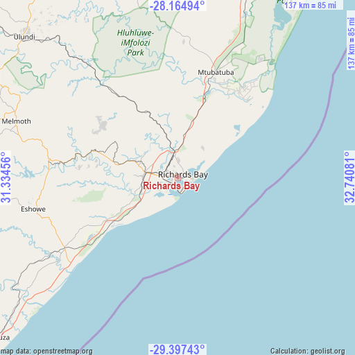
Richards Bay GPS coordinates[2]
28° 46' 58.836" South, 32° 2' 15.648" East
| Map corner | latitude | longitude |
|---|---|---|
| Upper-left | -28.16494°, | 31.33456° |
| Center: | -28.78301°, | 32.03768° |
| Lower-right: | -29.39743°, | 32.74081° |
| Map W x H: | 137×137 km | = 85.1×85.1mi |
| max Lat: | -22.34881° ⇑53.4% North |
| Richards Bay: | -28.78301° |
| min Lat: | ⇓46.6% South -34.66739° |
| min Long | Richards Bay | max Long |
| 16.8697° | 32.03768° | 32.26762° |
| W 98.5%⇐ | ⇒1.5% E |
Elevation
Elevation of Richards Bay is 9 m = 30 ft, and this is 960.6 m = 3152 ft below average elevation for this country.
| Max E: |
1873 m = 6145 ft | 99.1% |
| Avg. | 969.6 m = 3181 ft | |
| Richards Bay | 9 m = 30 ft | |
Min E: |
7 m = 23 ft | 0.9% |
See also: Richards Bay elevation on elevation.city.
Geographical zone
Richards Bay is located in South temperate zone (between Tropic of Capricorn and the Antarctic Circle). Distance of this Southern Tropic circle is 594.5 km =369.4 mi to North.| Distance of | km | miles | from Richards Bay |
|---|---|---|---|
| Equator | 3200.4 | 1988.6 | to North |
| Tropic Capricorn | 594.5 | 369.4 | to North |
| Antarctic Circle | 4200.8 | 2610.3 | to South |
| South Pole | 6806.7 | 4229.5 | to South |


Nearby cities:
15 places around Richards Bay: (largest is in red/bold)
• Ballito
116 km =72.1 mi,  223°
223°
• Empangeni
14.3 km =8.9 mi,  279°
279°
• Eshowe
56.5 km =35.1 mi,  258°
258°
• Hlabisa
72.6 km =45.1 mi,  347°
347°
• Hluhluwe
87.9 km =54.6 mi,  14°
14°
• KwaDukuza
94.7 km =58.8 mi,  230°
230°
• KwaMbonambi
21.2 km =13.2 mi, 13°
• Mandeni
72.9 km =45.3 mi,  236°
236°
• Melmoth
66.1 km =41.1 mi,  289°
289°
• Mtubatuba
43.1 km =26.8 mi,  19°
19°
• Nkandla
94.1 km =58.5 mi, 281°
• Nongoma
104.3 km =64.8 mi,  338°
338°
• Sundumbili
73.5 km =45.7 mi, 237°
• Ulundi
78.5 km =48.8 mi,  309°
309°
• eSikhaleni
16.6 km =10.3 mi, 233°
Sources, notices
• [Note1] Compared only with cities in South Africa existing in our database
• [Src1] Map data: © OpenStreetMap contributors (CC-BY-SA)
• [Src2] Other city data from geonames.org with taken over terms of usage.
• [Src3] Geographical zone / Annual Mean Temperature by Robert A. Rohde @ Wikipedia
