KwaDukuza geodata
KwaDukuza (KwaZulu-Natal) is a populated place; located in South Africa in Africa/Johannesburg (GMT+2) time zone. With population of 59,899 people, there are 84 cities with bigger population in this country. Compared to other cities in South Africa, 59% of cities are located further ↑North; 95% of cities are located further ←West and 87.6% of cities have higher elevation than KwaDukuza. Note1
Administrative division(s):
- Level 1: KwaZulu-Natal
- Level 2: iLembe District Municipality
- Level 3: KwaDukuza


KwaDukuza GPS coordinates[2]
29° 19' 41.376" South, 31° 17' 22.344" East
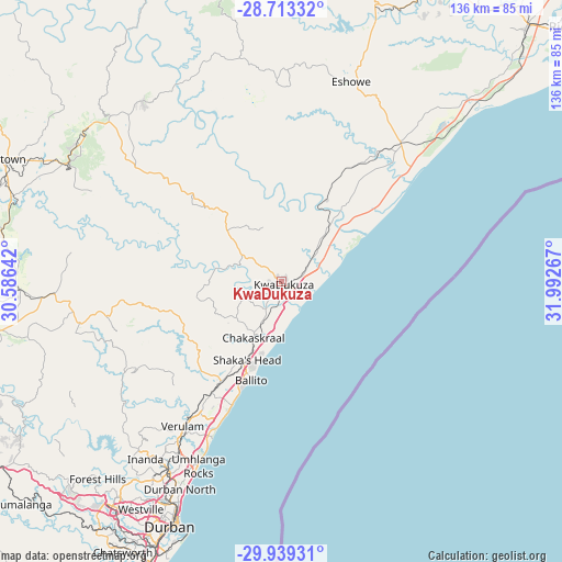
| Map corner | latitude | longitude |
|---|---|---|
| Upper-left | -28.71332°, | 30.58642° |
| Center: | -29.32816°, | 31.28954° |
| Lower-right: | -29.93931°, | 31.99267° |
| Map W x H: | 136.3×136.3 km | = 84.7×84.7mi |
| max Lat: | -22.34881° ⇑59% North |
| KwaDukuza: | -29.32816° |
| min Lat: | ⇓41% South -34.66739° |
| min Long | KwaDukuza | max Long |
| 16.8697° | 31.28954° | 32.26762° |
| W 95%⇐ | ⇒5% E |
Elevation
Elevation of KwaDukuza is 111 m = 364 ft, and this is 858.6 m = 2817 ft below average elevation for this country.
| Max E: |
1873 m = 6145 ft | 87.6% |
| Avg. | 969.6 m = 3181 ft | |
| KwaDukuza | 111 m = 364 ft | |
Min E: |
7 m = 23 ft | 12.4% |
See also: KwaDukuza elevation on elevation.city.
Geographical zone
KwaDukuza is located in South temperate zone (between Tropic of Capricorn and the Antarctic Circle). Distance of this Southern Tropic circle is 655.1 km =407.1 mi to North.| Distance of | km | miles | from KwaDukuza |
|---|---|---|---|
| Equator | 3261 | 2026.3 | to North |
| Tropic Capricorn | 655.1 | 407.1 | to North |
| Antarctic Circle | 4140.2 | 2572.6 | to South |
| South Pole | 6746.1 | 4191.8 | to South |


Nearby cities:
15 places around KwaDukuza: (largest is in red/bold)
• Ballito
24.5 km =15.2 mi,  197°
197°
• Berea
64.9 km =40.3 mi,  206°
206°
• Camperdown
84.9 km =52.8 mi,  238°
238°
• Durban
64.1 km =39.8 mi, 203°
• Eshowe
52.1 km =32.4 mi,  19°
19°
• Greytown
73.7 km =45.8 mi,  293°
293°
• Mandeni
23.5 km =14.6 mi,  30°
30°
• Melmoth
83.1 km =51.6 mi,  7°
7°
• Mpumalanga
83 km =51.6 mi,  229°
229°
• Ndwedwe
40.9 km =25.4 mi, 239°
• Nkandla
81 km =50.3 mi,  346°
346°
• Sundumbili
24 km =14.9 mi, 25°
• Tongaat Beach
34.4 km =21.4 mi, 202°
• Wartburg
70.1 km =43.6 mi,  260°
260°
• eSikhaleni
78.1 km =48.5 mi,  49°
49°
Sources, notices
• [Note1] Compared only with cities in South Africa existing in our database
• [Src1] Map data: © OpenStreetMap contributors (CC-BY-SA)
• [Src2] Other city data from geonames.org with taken over terms of usage.
• [Src3] Geographical zone / Annual Mean Temperature by Robert A. Rohde @ Wikipedia
