eSikhaleni geodata
eSikhaleni (KwaZulu-Natal) is a populated place; located in South Africa in Africa/Johannesburg (GMT+2) time zone. With population of 49,265 people, there are 95 cities with bigger population in this country. Compared to other cities in South Africa, 53.7% of cities are located further ↑North; 97.9% of cities are located further ←West and 97.9% of cities have higher elevation than eSikhaleni. Note1
Administrative division(s):
- Level 1: KwaZulu-Natal
- Level 2: uThungulu District Municipality
- Level 3: uMhlathuze


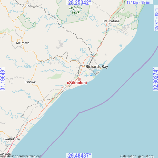
eSikhaleni GPS coordinates[2]
28° 52' 15.492" South, 31° 53' 58.596" East
| Map corner | latitude | longitude |
|---|---|---|
| Upper-left | -28.25342°, | 31.19649° |
| Center: | -28.87097°, | 31.89961° |
| Lower-right: | -29.48487°, | 32.60274° |
| Map W x H: | 136.9×136.9 km | = 85.1×85.1mi |
| max Lat: | -22.34881° ⇑53.7% North |
| eSikhaleni: | -28.87097° |
| min Lat: | ⇓46.3% South -34.66739° |
| min Long | eSikhaleni | max Long |
| 16.8697° | 31.89961° | 32.26762° |
| W 97.9%⇐ | ⇒2.1% E |
Elevation
Elevation of eSikhaleni is 15 m = 49 ft, and this is 954.6 m = 3132 ft below average elevation for this country.
| Max E: |
1873 m = 6145 ft | 97.9% |
| Avg. | 969.6 m = 3181 ft | |
| eSikhaleni | 15 m = 49 ft | |
Min E: |
7 m = 23 ft | 2.1% |
See also: eSikhaleni elevation on elevation.city.
Geographical zone
eSikhaleni is located in South temperate zone (between Tropic of Capricorn and the Antarctic Circle). Distance of this Southern Tropic circle is 604.2 km =375.4 mi to North.| Distance of | km | miles | from eSikhaleni |
|---|---|---|---|
| Equator | 3210.2 | 1994.7 | to North |
| Tropic Capricorn | 604.2 | 375.4 | to North |
| Antarctic Circle | 4191 | 2604.2 | to South |
| South Pole | 6796.9 | 4223.4 | to South |


Nearby cities:
15 places around eSikhaleni: (largest is in red/bold)
• Ballito
99.7 km =62 mi,  221°
221°
• Empangeni
12.1 km =7.5 mi,  357°
357°
• Eshowe
41.9 km =26 mi,  267°
267°
• Hlabisa
80.7 km =50.1 mi, 358°
• Hluhluwe
101.3 km =62.9 mi,  20°
20°
• KwaDukuza
78.1 km =48.5 mi,  229°
229°
• KwaMbonambi
35.5 km =22.1 mi,  31°
31°
• Mandeni
56.3 km =35 mi,  236°
236°
• Melmoth
58.3 km =36.2 mi,  302°
302°
• Mtubatuba
57.6 km =35.8 mi, 28°
• Nkandla
83.6 km =51.9 mi,  289°
289°
• Nongoma
109.7 km =68.2 mi,  347°
347°
• Richards Bay
16.6 km =10.3 mi,  53°
53°
• Sundumbili
56.9 km =35.4 mi, 239°
• Ulundi
76 km =47.2 mi,  321°
321°
Sources, notices
• [Note1] Compared only with cities in South Africa existing in our database
• [Src1] Map data: © OpenStreetMap contributors (CC-BY-SA)
• [Src2] Other city data from geonames.org with taken over terms of usage.
• [Src3] Geographical zone / Annual Mean Temperature by Robert A. Rohde @ Wikipedia
