Nkandla geodata
Nkandla (KwaZulu-Natal) is a seat of a third-order administrative division; located in South Africa in Africa/Johannesburg (GMT+2) time zone. In our database, there are 257 cities with bigger population. Compared to other cities in South Africa, 51% of cities are located further ↑North; 93.5% of cities are located further ←West and 50.4% of cities have higher elevation than Nkandla. Note1
Administrative division(s):
- Level 1: KwaZulu-Natal
- Level 2: uThungulu District Municipality
- Level 3: Nkandla


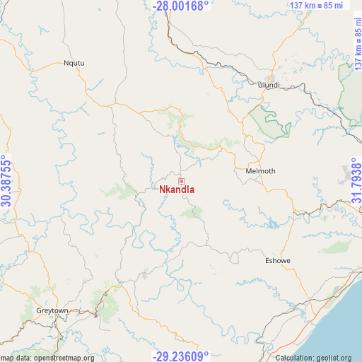
Nkandla GPS coordinates[2]
28° 37' 14.52" South, 31° 5' 26.412" East
| Map corner | latitude | longitude |
|---|---|---|
| Upper-left | -28.00168°, | 30.38755° |
| Center: | -28.6207°, | 31.09067° |
| Lower-right: | -29.23609°, | 31.7938° |
| Map W x H: | 137.3×137.3 km | = 85.3×85.3mi |
| max Lat: | -22.34881° ⇑51% North |
| Nkandla: | -28.6207° |
| min Lat: | ⇓49% South -34.66739° |
| min Long | Nkandla | max Long |
| 16.8697° | 31.09067° | 32.26762° |
| W 93.5%⇐ | ⇒6.5% E |
Elevation
Elevation of Nkandla is 1112 m = 3648 ft, and this is 142.4 m = 467 ft above average elevation for this country.
| Max E: |
1873 m = 6145 ft | 50.4% |
| Nkandla | 1112 m 3648 ft | |
| Avg. | 969.6 m = 3181 ft | |
Min E: |
7 m = 23 ft | 49.6% |
See also: South Africa elevation on elevation.city.
Geographical zone
Nkandla is located in South temperate zone (between Tropic of Capricorn and the Antarctic Circle). Distance of this Southern Tropic circle is 576.4 km =358.2 mi to North.| Distance of | km | miles | from Nkandla |
|---|---|---|---|
| Equator | 3182.3 | 1977.4 | to North |
| Tropic Capricorn | 576.4 | 358.2 | to North |
| Antarctic Circle | 4218.9 | 2621.5 | to South |
| South Pole | 6824.7 | 4240.7 | to South |


Nearby cities:
15 places around Nkandla: (largest is in red/bold)
• Ekuvukeni
93 km =57.8 mi,  280°
280°
• Empangeni
79.8 km =49.6 mi,  101°
101°
• Eshowe
47.3 km =29.4 mi,  128°
128°
• Greytown
69.2 km =43 mi,  224°
224°
• Hlabisa
93.4 km =58 mi,  55°
55°
• KwaDukuza
81 km =50.3 mi,  166°
166°
• Mandeni
66.4 km =41.3 mi,  151°
151°
• Melmoth
30.2 km =18.8 mi,  82°
82°
• Mondlo
79.8 km =49.6 mi,  332°
332°
• Nongoma
96.1 km =59.7 mi,  34°
34°
• Richards Bay
94.1 km =58.5 mi, 101°
• Sundumbili
64.4 km =40 mi, 152°
• Tugela Ferry
63.9 km =39.7 mi,  257°
257°
• Ulundi
44.9 km =27.9 mi,  45°
45°
• eSikhaleni
83.6 km =51.9 mi,  109°
109°
Sources, notices
• [Note1] Compared only with cities in South Africa existing in our database
• [Src1] Map data: © OpenStreetMap contributors (CC-BY-SA)
• [Src2] Other city data from geonames.org with taken over terms of usage.
• [Src3] Geographical zone / Annual Mean Temperature by Robert A. Rohde @ Wikipedia
