Mount Frere geodata
Mount Frere (Eastern Cape) is a seat of a third-order administrative division; located in South Africa in Africa/Johannesburg (GMT+2) time zone. In our database, there are 257 cities with bigger population. Compared to other cities in South Africa, 72% of cities are located further ↑North; 68.4% of cities are located further ←West and 52.5% of cities have lower elevation than Mount Frere. Note1
Administrative division(s):
- Level 1: Eastern Cape
- Level 2: Alfred Nzo District Municipality
- Level 3: Umzimvubu


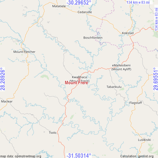
Mount Frere GPS coordinates[2]
30° 54' 6.228" South, 28° 59' 32.568" East
| Map corner | latitude | longitude |
|---|---|---|
| Upper-left | -30.29652°, | 28.28926° |
| Center: | -30.90173°, | 28.99238° |
| Lower-right: | -31.50314°, | 29.69551° |
| Map W x H: | 134.2×134.2 km | = 83.4×83.4mi |
| max Lat: | -22.34881° ⇑72% North |
| Mount Frere: | -30.90173° |
| min Lat: | ⇓28% South -34.66739° |
| min Long | Mount Frere | max Long |
| 16.8697° | 28.99238° | 32.26762° |
| W 68.4%⇐ | ⇒31.6% E |
Elevation
Elevation of Mount Frere is 1153 m = 3783 ft, and this is 183.4 m = 602 ft above average elevation for this country.
| Max E: |
1873 m = 6145 ft | 47.5% |
| Mount Frere | 1153 m 3783 ft | |
| Avg. | 969.6 m = 3181 ft | |
Min E: |
7 m = 23 ft | 52.5% |
See also: South Africa elevation on elevation.city.
Geographical zone
Mount Frere is located in South temperate zone (between Tropic of Capricorn and the Antarctic Circle). Distance of this Southern Tropic circle is 830 km =515.7 mi to North.| Distance of | km | miles | from Mount Frere |
|---|---|---|---|
| Equator | 3436 | 2135 | to North |
| Tropic Capricorn | 830 | 515.7 | to North |
| Antarctic Circle | 3965.2 | 2463.9 | to South |
| South Pole | 6571.1 | 4083.1 | to South |


Nearby cities:
15 places around Mount Frere: (largest is in red/bold)
• Bizana
82.3 km =51.1 mi,  86°
86°
• Creighton
126.7 km =78.7 mi,  39°
39°
• Elliot
118.9 km =73.9 mi,  246°
246°
• Flagstaff
51.9 km =32.2 mi,  112°
112°
• Harding
92.6 km =57.5 mi,  66°
66°
• Izingolweni
108.7 km =67.5 mi,  83°
83°
• Kokstad
57.1 km =35.5 mi,  46°
46°
• Libode
71.4 km =44.4 mi,  178°
178°
• Maclear
63.9 km =39.7 mi, 252°
• Margate
131.6 km =81.8 mi, 88°
• Matatiele
64.4 km =40 mi,  344°
344°
• Mount Ayliff
37.2 km =23.1 mi, 73°
• Mthatha
78.9 km =49 mi,  194°
194°
• Port Saint John’s
95.8 km =59.5 mi,  146°
146°
• Qumbu
31.3 km =19.4 mi,  201°
201°
Sources, notices
• [Note1] Compared only with cities in South Africa existing in our database
• [Src1] Map data: © OpenStreetMap contributors (CC-BY-SA)
• [Src2] Other city data from geonames.org with taken over terms of usage.
• [Src3] Geographical zone / Annual Mean Temperature by Robert A. Rohde @ Wikipedia
