Mīr Bachah Kōṯ geodata
Mīr Bachah Kōṯ (Kabul) is a seat of a second-order administrative division; located in Afghanistan in Asia/Kabul (GMT+4.5) time zone. With population of 5,405 people, there are 86 cities with bigger population in this country. Compared to other cities in Afghanistan, 51.8% of cities are located further ↓South; 62.1% of cities are located further ←West and 61.1% of cities have lower elevation than Mīr Bachah Kōṯ. Note1


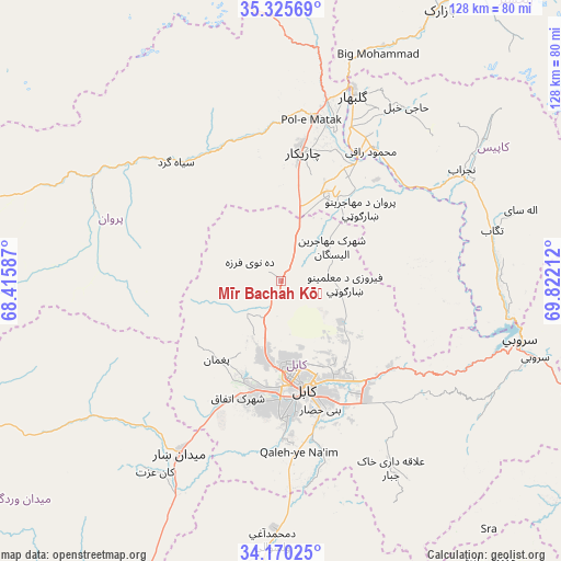
Mīr Bachah Kōṯ GPS coordinates[2]
34° 44' 59.964" North, 69° 7' 8.364" East
| Map corner | latitude | longitude |
|---|---|---|
| Upper-left | 35.32569°, | 68.41587° |
| Center: | 34.74999°, | 69.11899° |
| Lower-right: | 34.17025°, | 69.82212° |
| Map W x H: | 128.5×128.5 km | = 79.8×79.8mi |
| max Lat: | 38.4435° ⇑48.2% North |
| Mīr Bachah Kōṯ: | 34.74999° |
| min Lat: | ⇓51.8% South 30.15° |
| min Long | Mīr Bachah Kō | max Long |
| 61.06667° | 69.11899° | 72.318° |
| W 62.1%⇐ | ⇒37.9% E |
Elevation
Elevation of Mīr Bachah Kōṯ is 1673 m = 5489 ft, and this is 254.6 m = 835 ft above average elevation for this country.
| Max E: |
3068 m = 10066 ft | 38.9% |
| Mīr Bachah Kōṯ | 1673 m 5489 ft | |
| Avg. | 1418.4 m = 4654 ft | |
Min E: |
254 m = 833 ft | 61.1% |
See also: Afghanistan elevation on elevation.city.
Geographical zone
Mīr Bachah Kōṯ is located in North temperate zone (between Tropic of Cancer and the Arctic Circle). Distance of this Northern Tropic circle is 1257.9 km =781.6 mi to South.| Distance of | km | miles | from Mīr Bachah Kōṯ |
|---|---|---|---|
| North Pole | 6143.2 | 3817.2 | to North |
| Arctic Circle | 3537.3 | 2198 | to North |
| Tropic Cancer | 1257.9 | 781.6 | to South |
| Equator | 3863.8 | 2400.9 | to South |


Nearby cities:
15 places around Mīr Bachah Kōṯ: (largest is in red/bold)
• Bagrāmī
31.8 km =19.8 mi,  153°
153°
• Chandal Bā’ī
23.7 km =14.7 mi,  219°
219°
• Charikar
29.7 km =18.5 mi,  9°
9°
• Deh-e Now
6.5 km =4 mi,  267°
267°
• Ghulām ‘Alī
24.5 km =15.2 mi,  24°
24°
• Istālif
9.9 km =6.2 mi,  337°
337°
• Kabul
25.1 km =15.6 mi,  168°
168°
• Kalakān
4.7 km =2.9 mi,  37°
37°
• Paghmān
23.7 km =14.7 mi, 220°
• Pul-e Sangī
21.1 km =13.1 mi,  142°
142°
• Qarah Bāgh Bāzār
12.4 km =7.7 mi, 22°
• Qāshqāl
33.8 km =21 mi, 342°
• Surkh Bilandī
11 km =6.8 mi,  228°
228°
• Zargarān
6.9 km =4.3 mi,  307°
307°
• Ḏanḏar
32.8 km =20.4 mi,  82°
82°
Sources, notices
• [Note1] Compared only with cities in Afghanistan existing in our database
• [Src1] Map data: © OpenStreetMap contributors (CC-BY-SA)
• [Src2] Other city data from geonames.org with taken over terms of usage.
• [Src3] Geographical zone / Annual Mean Temperature by Robert A. Rohde @ Wikipedia
