Chandal BДҒвҖҷД« geodata
Chandal BДҒвҖҷД« (Kabul) is a seat of a second-order administrative division; located in Afghanistan in Asia/Kabul (GMT+4.5) time zone. In our database, there are 93 cities with bigger population. Compared to other cities in Afghanistan, 52.7% of cities are located further ↑North; 58.5% of cities are located further ←West and 87.5% of cities have lower elevation than Chandal BДҒвҖҷД«. Note1


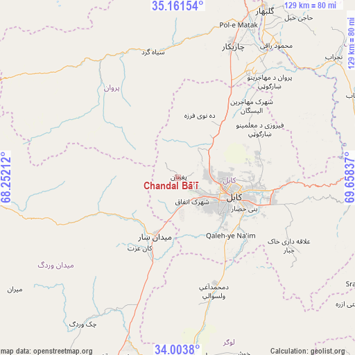
Chandal BДҒвҖҷД« GPS coordinates[2]
34° 35' 4.884" North, 68° 57' 18.864" East
| Map corner | latitude | longitude |
|---|---|---|
| Upper-left | 35.16154°, | 68.25212° |
| Center: | 34.58469°, | 68.95524° |
| Lower-right: | 34.0038°, | 69.65837° |
| Map W x H: | 128.7×128.7 km | = 80Г—80mi |
| max Lat: | 38.4435° ⇑52.7% North |
| Chandal BДҒвҖҷД«: | 34.58469° |
| min Lat: | ⇓47.3% South 30.15° |
| min Long | Chandal BДҒвҖҷД | max Long |
| 61.06667° | 68.95524° | 72.318° |
| W 58.5%⇐ | ⇒41.5% E |
Elevation
Elevation of Chandal BДҒвҖҷД« is 2304 m = 7559 ft, and this is 885.6 m = 2906 ft above average elevation for this country.
| Max E: |
3068 m = 10066 ft | 12.5% |
| Chandal BДҒвҖҷД« | 2304 m 7559 ft | |
| Avg. | 1418.4 m = 4654 ft | |
Min E: |
254 m = 833 ft | 87.5% |
See also: Afghanistan elevation on elevation.city.
Geographical zone
Chandal BДҒвҖҷД« is located in North temperate zone (between Tropic of Cancer and the Arctic Circle). Distance of this Northern Tropic circle is 1239.5 km =770.2 mi to South.| Distance of | km | miles | from Chandal BДҒвҖҷД« |
|---|---|---|---|
| North Pole | 6161.6 | 3828.6 | to North |
| Arctic Circle | 3555.7 | 2209.4 | to North |
| Tropic Cancer | 1239.5 | 770.2 | to South |
| Equator | 3845.5 | 2389.5 | to South |


Nearby cities:
15 places around Chandal BДҒвҖҷД«: (largest is in red/bold)
• BagrДҒmД«
30.9 km =19.2 mi,  109°
109°
• Deh-e Now
20 km =12.4 mi,  25°
25°
• IstДҒlif
29.8 km =18.5 mi,  22°
22°
• JalrД“z
30.3 km =18.8 mi,  245°
245°
• Kabul
20.9 km =13 mi, 107°
• KalakДҒn
28.4 km =17.6 mi,  38°
38°
• Maydanshakhr
22.6 km =14 mi,  201°
201°
• Muбё©ammad ДҖghah WuluswДҒlД«
43.3 km =26.9 mi,  162°
162°
• MД«r Bachah KЕҚб№Ҝ
23.7 km =14.7 mi, 39°
• PaghmДҒn
0.5 km =0.3 mi,  311°
311°
• Pul-e SangД«
27.9 km =17.3 mi,  86°
86°
• QalвҖҳah-ye NaвҖҳД«m
28.3 km =17.6 mi,  136°
136°
• Qarah BДҒgh BДҒzДҒr
35.7 km =22.2 mi, 33°
• Surkh BilandД«
13 km =8.1 mi, 31°
• ZargarДҒn
24.5 km =15.2 mi, 22°
Sources, notices
• [Note1] Compared only with cities in Afghanistan existing in our database
• [Src1] Map data: © OpenStreetMap contributors (CC-BY-SA)
• [Src2] Other city data from geonames.org with taken over terms of usage.
• [Src3] Geographical zone / Annual Mean Temperature by Robert A. Rohde @ Wikipedia
