Ghulām ‘Alī geodata
Ghulām ‘Alī (Parwan) is a seat of a second-order administrative division; located in Afghanistan in Asia/Kabul (GMT+4.5) time zone. In our database, there are 93 cities with bigger population. Compared to other cities in Afghanistan, 58.5% of cities are located further ↓South; 66.2% of cities are located further ←West and 54% of cities have lower elevation than Ghulām ‘Alī. Note1


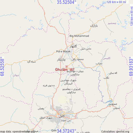
Ghulām ‘Alī GPS coordinates[2]
34° 57' 2.736" North, 69° 13' 43.32" East
| Map corner | latitude | longitude |
|---|---|---|
| Upper-left | 35.52504°, | 68.52558° |
| Center: | 34.95076°, | 69.2287° |
| Lower-right: | 34.37243°, | 69.93183° |
| Map W x H: | 128.2×128.2 km | = 79.7×79.7mi |
| max Lat: | 38.4435° ⇑41.5% North |
| Ghulām ‘Alī: | 34.95076° |
| min Lat: | ⇓58.5% South 30.15° |
| min Long | Ghulām ‘Alī | max Long |
| 61.06667° | 69.2287° | 72.318° |
| W 66.2%⇐ | ⇒33.8% E |
Elevation
Elevation of Ghulām ‘Alī is 1489 m = 4885 ft, and this is 70.6 m = 232 ft above average elevation for this country.
| Max E: |
3068 m = 10066 ft | 46% |
| Ghulām ‘Alī | 1489 m 4885 ft | |
| Avg. | 1418.4 m = 4654 ft | |
Min E: |
254 m = 833 ft | 54% |
See also: Afghanistan elevation on elevation.city.
Geographical zone
Ghulām ‘Alī is located in North temperate zone (between Tropic of Cancer and the Arctic Circle). Distance of this Northern Tropic circle is 1280.2 km =795.5 mi to South.| Distance of | km | miles | from Ghulām ‘Alī |
|---|---|---|---|
| North Pole | 6120.9 | 3803.3 | to North |
| Arctic Circle | 3515 | 2184.1 | to North |
| Tropic Cancer | 1280.2 | 795.5 | to South |
| Equator | 3886.2 | 2414.8 | to South |


Nearby cities:
15 places around Ghulām ‘Alī: (largest is in red/bold)
• Bāgh-e Maīdān
30.1 km =18.7 mi,  357°
357°
• Charikar
8.7 km =5.4 mi,  323°
323°
• Deh-e Now
28 km =17.4 mi,  216°
216°
• Ibrāhīm Khān
11.7 km =7.3 mi,  12°
12°
• Istālif
19 km =11.8 mi,  226°
226°
• Jabal os Saraj
18.7 km =11.6 mi,  2°
2°
• Kalakān
19.9 km =12.4 mi,  201°
201°
• Mīr Bachah Kōṯ
24.5 km =15.2 mi, 204°
• Qarah Bāgh Bāzār
12.1 km =7.5 mi,  205°
205°
• Qāshqāl
22.5 km =14 mi,  296°
296°
• Sidqābād
13.7 km =8.5 mi,  54°
54°
• Zargarān
23.9 km =14.9 mi, 220°
• Ḏanḏar
28.6 km =17.8 mi,  128°
128°
• Ḩājī Khēl
25.6 km =15.9 mi, 46°
• ’Unābah
34.1 km =21.2 mi,  23°
23°
Sources, notices
• [Note1] Compared only with cities in Afghanistan existing in our database
• [Src1] Map data: © OpenStreetMap contributors (CC-BY-SA)
• [Src2] Other city data from geonames.org with taken over terms of usage.
• [Src3] Geographical zone / Annual Mean Temperature by Robert A. Rohde @ Wikipedia
