Charikar geodata
Charikar (Parwan) is a seat of a first-order administrative division; located in Afghanistan in Asia/Kabul (GMT+4.5) time zone. With population of 53,676 people, there are 19 cities with bigger population in this country. Compared to other cities in Afghanistan, 60.8% of cities are located further ↓South; 64.3% of cities are located further ←West and 56.9% of cities have lower elevation than Charikar. Note1


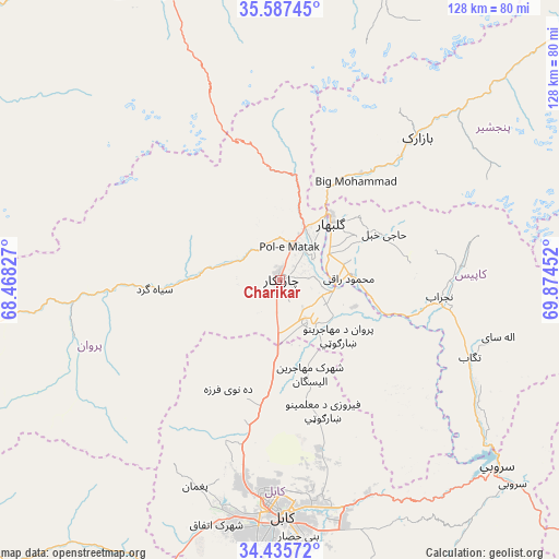
Charikar GPS coordinates[2]
35° 0' 48.996" North, 69° 10' 17.004" East
| Map corner | latitude | longitude |
|---|---|---|
| Upper-left | 35.58745°, | 68.46827° |
| Center: | 35.01361°, | 69.17139° |
| Lower-right: | 34.43572°, | 69.87452° |
| Map W x H: | 128.1×128.1 km | = 79.6×79.6mi |
| max Lat: | 38.4435° ⇑39.2% North |
| Charikar: | 35.01361° |
| min Lat: | ⇓60.8% South 30.15° |
| min Long | Charikar | max Long |
| 61.06667° | 69.17139° | 72.318° |
| W 64.3%⇐ | ⇒35.7% E |
Elevation
Elevation of Charikar is 1554 m = 5098 ft, and this is 135.6 m = 445 ft above average elevation for this country.
| Max E: |
3068 m = 10066 ft | 43.1% |
| Charikar | 1554 m 5098 ft | |
| Avg. | 1418.4 m = 4654 ft | |
Min E: |
254 m = 833 ft | 56.9% |
See also: Charikar elevation on elevation.city.
Geographical zone
Charikar is located in North temperate zone (between Tropic of Cancer and the Arctic Circle). Distance of this Northern Tropic circle is 1287.2 km =799.8 mi to South.| Distance of | km | miles | from Charikar |
|---|---|---|---|
| North Pole | 6113.9 | 3799 | to North |
| Arctic Circle | 3508 | 2179.8 | to North |
| Tropic Cancer | 1287.2 | 799.8 | to South |
| Equator | 3893.1 | 2419.1 | to South |


Nearby cities:
15 places around Charikar: (largest is in red/bold)
• Bāgh-e Maīdān
23.4 km =14.5 mi,  9°
9°
• Deh-e Now
31.6 km =19.6 mi,  200°
200°
• Ghulām ‘Alī
8.7 km =5.4 mi,  143°
143°
• Ibrāhīm Khān
8.9 km =5.5 mi,  60°
60°
• Istālif
21.9 km =13.6 mi, 203°
• Jabal os Saraj
13.1 km =8.1 mi,  27°
27°
• Kalakān
25.6 km =15.9 mi,  184°
184°
• Mīr Bachah Kōṯ
29.7 km =18.5 mi,  189°
189°
• Qarah Bāgh Bāzār
17.9 km =11.1 mi, 180°
• Qāshqāl
15.3 km =9.5 mi,  280°
280°
• Sidqābād
16.4 km =10.2 mi,  86°
86°
• Siyāhgird
28.8 km =17.9 mi,  268°
268°
• Zargarān
27.1 km =16.8 mi, 202°
• Ḩājī Khēl
26.1 km =16.2 mi,  65°
65°
• ’Unābah
30.7 km =19.1 mi,  37°
37°
Sources, notices
• [Note1] Compared only with cities in Afghanistan existing in our database
• [Src1] Map data: © OpenStreetMap contributors (CC-BY-SA)
• [Src2] Other city data from geonames.org with taken over terms of usage.
• [Src3] Geographical zone / Annual Mean Temperature by Robert A. Rohde @ Wikipedia
