Sidqābād geodata
Sidqābād (Kapisa) is a seat of a first-order administrative division; located in Afghanistan in Asia/Kabul (GMT+4.5) time zone. With population of 7,407 people, there are 79 cities with bigger population in this country. Compared to other cities in Afghanistan, 61.4% of cities are located further ↓South; 69.8% of cities are located further ←West and 53.7% of cities have lower elevation than Sidqābād. Note1


Sidqābād GPS coordinates[2]
35° 1' 22.728" North, 69° 21' 4.032" East
| Map corner | latitude | longitude |
|---|---|---|
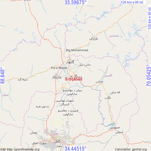
| Upper-left | 35.59675°, | 68.648° |
| Center: | 35.02298°, | 69.35112° |
| Lower-right: | 34.44515°, | 70.05425° |
| Map W x H: | 128×128 km | = 79.5×79.5mi |
| max Lat: | 38.4435° ⇑38.6% North |
| Sidqābād: | 35.02298° |
| min Lat: | ⇓61.4% South 30.15° |
| min Long | Sidqābād | max Long |
| 61.06667° | 69.35112° | 72.318° |
| W 69.8%⇐ | ⇒30.2% E |
Elevation
Elevation of Sidqābād is 1486 m = 4875 ft, and this is 67.6 m = 222 ft above average elevation for this country.
| Max E: |
3068 m = 10066 ft | 46.3% |
| Sidqābād | 1486 m 4875 ft | |
| Avg. | 1418.4 m = 4654 ft | |
Min E: |
254 m = 833 ft | 53.7% |
See also: Afghanistan elevation on elevation.city.
Geographical zone
Sidqābād is located in North temperate zone (between Tropic of Cancer and the Arctic Circle). Distance of this Northern Tropic circle is 1288.3 km =800.5 mi to South.| Distance of | km | miles | from Sidqābād |
|---|---|---|---|
| North Pole | 6112.9 | 3798.4 | to North |
| Arctic Circle | 3507 | 2179.1 | to North |
| Tropic Cancer | 1288.3 | 800.5 | to South |
| Equator | 3894.2 | 2419.7 | to South |


Nearby cities:
15 places around Sidqābād: (largest is in red/bold)
• Bāgh-e Maīdān
25.4 km =15.8 mi,  330°
330°
• Bāzārak
35.5 km =22.1 mi,  24°
24°
• Charikar
16.4 km =10.2 mi,  266°
266°
• Ghulām ‘Alī
13.7 km =8.5 mi,  234°
234°
• Ibrāhīm Khān
9.3 km =5.8 mi,  291°
291°
• Istālif
32.7 km =20.3 mi, 229°
• Jabal os Saraj
14.8 km =9.2 mi,  315°
315°
• Kalakān
32.3 km =20.1 mi,  214°
214°
• Qarah Bāgh Bāzār
25.1 km =15.6 mi,  221°
221°
• Qāshqāl
31.4 km =19.5 mi, 273°
• Shērwānī-ye Bālā
22.6 km =14 mi,  92°
92°
• Tagāb
33 km =20.5 mi,  124°
124°
• Ḏanḏar
28.2 km =17.5 mi,  156°
156°
• Ḩājī Khēl
12.2 km =7.6 mi,  37°
37°
• ’Unābah
23.4 km =14.5 mi,  5°
5°
Sources, notices
• [Note1] Compared only with cities in Afghanistan existing in our database
• [Src1] Map data: © OpenStreetMap contributors (CC-BY-SA)
• [Src2] Other city data from geonames.org with taken over terms of usage.
• [Src3] Geographical zone / Annual Mean Temperature by Robert A. Rohde @ Wikipedia
