Vosketap’ geodata
Vosketap’ (Ararat) is a populated place; located in Armenia in Asia/Yerevan (GMT+4) time zone. With population of 4,080 people, there are 63 cities with bigger population in this country. Compared to other cities in Armenia, 87.6% of cities are located further ↑North; 61.1% of cities are located further ←West and 85.4% of cities have higher elevation than Vosketap’. Note1


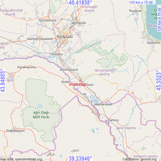
Vosketap’ GPS coordinates[2]
39° 52' 52.104" North, 44° 38' 57.012" East
| Map corner | latitude | longitude |
|---|---|---|
| Upper-left | 40.41858°, | 43.94605° |
| Center: | 39.88114°, | 44.64917° |
| Lower-right: | 39.33946°, | 45.3523° |
| Map W x H: | 120×120 km | = 74.6×74.6mi |
| max Lat: | 41.24358° ⇑87.6% North |
| Vosketap’: | 39.88114° |
| min Lat: | ⇓12.4% South 38.90292° |
| min Long | Vosketap’ | max Long |
| 43.74722° | 44.64917° | 46.5446° |
| W 61.1%⇐ | ⇒38.9% E |
Elevation
Elevation of Vosketap’ is 841 m = 2759 ft, and this is 460.5 m = 1511 ft below average elevation for this country.
| Max E: |
2169 m = 7116 ft | 85.4% |
| Avg. | 1301.5 m = 4270 ft | |
| Vosketap’ | 841 m = 2759 ft | |
Min E: |
440 m = 1444 ft | 14.6% |
See also: Armenia elevation on elevation.city.
Geographical zone
Vosketap’ is located in North temperate zone (between Tropic of Cancer and the Arctic Circle). Distance of this Northern Tropic circle is 1828.4 km =1136.1 mi to South.| Distance of | km | miles | from Vosketap’ |
|---|---|---|---|
| North Pole | 5572.7 | 3462.7 | to North |
| Arctic Circle | 2966.8 | 1843.5 | to North |
| Tropic Cancer | 1828.4 | 1136.1 | to South |
| Equator | 4434.4 | 2755.4 | to South |


Nearby cities:
15 places around Vosketap’: (largest is in red/bold)
• Aralez
2.2 km =1.4 mi,  14°
14°
• Ararat
7.4 km =4.6 mi,  139°
139°
• Artashat
12.6 km =7.8 mi,  315°
315°
• Avshar
3 km =1.9 mi,  164°
164°
• Aygavan
2 km =1.2 mi,  116°
116°
• Aygepat
9.6 km =6 mi,  333°
333°
• Aygezard
9.1 km =5.7 mi, 333°
• Goravan
7.8 km =4.8 mi,  67°
67°
• Lusarrat
5.4 km =3.4 mi,  261°
261°
• Noyakert
5.9 km =3.7 mi, 162°
• Shahumyan
9.4 km =5.8 mi, 315°
• Sisavan
3.4 km =2.1 mi,  27°
27°
• Vedi
7.4 km =4.6 mi,  60°
60°
• Vostan
12.1 km =7.5 mi, 320°
• Yeghegnavan
5.3 km =3.3 mi,  208°
208°
Sources, notices
• [Note1] Compared only with cities in Armenia existing in our database
• [Src1] Map data: © OpenStreetMap contributors (CC-BY-SA)
• [Src2] Other city data from geonames.org with taken over terms of usage.
• [Src3] Geographical zone / Annual Mean Temperature by Robert A. Rohde @ Wikipedia
