Yeghegnavan geodata
Yeghegnavan (Ararat) is a populated place; located in Armenia in Asia/Yerevan (GMT+4) time zone. With population of 1,221 people, there are 264 cities with bigger population in this country. Compared to other cities in Armenia, 89.5% of cities are located further ↑North; 59.6% of cities are located further ←West and 96.2% of cities have higher elevation than Yeghegnavan. Note1


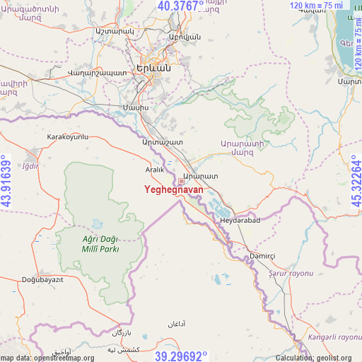
Yeghegnavan GPS coordinates[2]
39° 50' 20.148" North, 44° 37' 10.236" East
| Map corner | latitude | longitude |
|---|---|---|
| Upper-left | 40.3767°, | 43.91639° |
| Center: | 39.83893°, | 44.61951° |
| Lower-right: | 39.29692°, | 45.32264° |
| Map W x H: | 120.1×120.1 km | = 74.6×74.6mi |
| max Lat: | 41.24358° ⇑89.5% North |
| Yeghegnavan: | 39.83893° |
| min Lat: | ⇓10.5% South 38.90292° |
| min Long | Yeghegnavan | max Long |
| 43.74722° | 44.61951° | 46.5446° |
| W 59.6%⇐ | ⇒40.4% E |
Elevation
Elevation of Yeghegnavan is 816 m = 2677 ft, and this is 485.5 m = 1593 ft below average elevation for this country.
| Max E: |
2169 m = 7116 ft | 96.2% |
| Avg. | 1301.5 m = 4270 ft | |
| Yeghegnavan | 816 m = 2677 ft | |
Min E: |
440 m = 1444 ft | 3.8% |
See also: Armenia elevation on elevation.city.
Geographical zone
Yeghegnavan is located in North temperate zone (between Tropic of Cancer and the Arctic Circle). Distance of this Northern Tropic circle is 1823.8 km =1133.3 mi to South.| Distance of | km | miles | from Yeghegnavan |
|---|---|---|---|
| North Pole | 5577.4 | 3465.6 | to North |
| Arctic Circle | 2971.5 | 1846.4 | to North |
| Tropic Cancer | 1823.8 | 1133.3 | to South |
| Equator | 4429.7 | 2752.5 | to South |


Nearby cities:
15 places around Yeghegnavan: (largest is in red/bold)
• Aralez
7.5 km =4.7 mi,  24°
24°
• Ararat
7.4 km =4.6 mi,  97°
97°
• Avshar
3.8 km =2.4 mi,  60°
60°
• Aygavan
5.7 km =3.5 mi,  48°
48°
• Aygepat
13.4 km =8.3 mi,  352°
352°
• Aygezard
12.9 km =8 mi, 353°
• Goravan
12.4 km =7.7 mi, 51°
• Lusarrat
4.8 km =3 mi,  324°
324°
• Noyakert
4.4 km =2.7 mi, 102°
• Shahumyan
12.1 km =7.5 mi,  340°
340°
• Sisavan
8.7 km =5.4 mi,  27°
27°
• Surenavan
14.2 km =8.8 mi,  110°
110°
• Vedi
12.3 km =7.6 mi, 47°
• Vosketap’
5.3 km =3.3 mi, 28°
• Vostan
14.9 km =9.3 mi, 339°
Sources, notices
• [Note1] Compared only with cities in Armenia existing in our database
• [Src1] Map data: © OpenStreetMap contributors (CC-BY-SA)
• [Src2] Other city data from geonames.org with taken over terms of usage.
• [Src3] Geographical zone / Annual Mean Temperature by Robert A. Rohde @ Wikipedia
