Lusarrat geodata
Lusarrat (Ararat) is a populated place; located in Armenia in Asia/Yerevan (GMT+4) time zone. With population of 2,780 people, there are 103 cities with bigger population in this country. Compared to other cities in Armenia, 87.9% of cities are located further ↑North; 55.4% of cities are located further ←West and 95.2% of cities have higher elevation than Lusarrat. Note1


Lusarrat GPS coordinates[2]
39° 52' 26.508" North, 44° 35' 12.408" East
| Map corner | latitude | longitude |
|---|---|---|
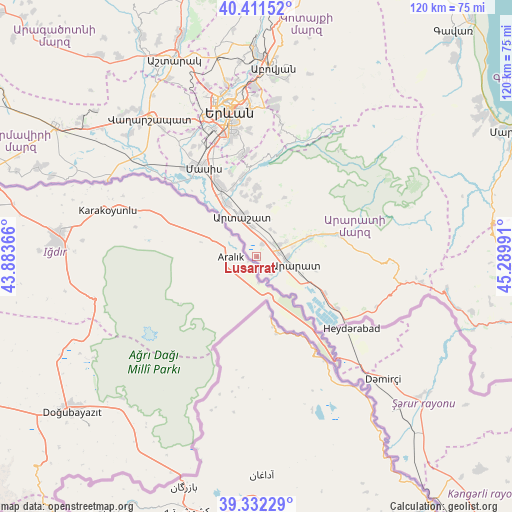
| Upper-left | 40.41152°, | 43.88366° |
| Center: | 39.87403°, | 44.58678° |
| Lower-right: | 39.33229°, | 45.28991° |
| Map W x H: | 120×120 km | = 74.6×74.6mi |
| max Lat: | 41.24358° ⇑87.9% North |
| Lusarrat: | 39.87403° |
| min Lat: | ⇓12.1% South 38.90292° |
| min Long | Lusarrat | max Long |
| 43.74722° | 44.58678° | 46.5446° |
| W 55.4%⇐ | ⇒44.6% E |
Elevation
Elevation of Lusarrat is 821 m = 2694 ft, and this is 480.5 m = 1576 ft below average elevation for this country.
| Max E: |
2169 m = 7116 ft | 95.2% |
| Avg. | 1301.5 m = 4270 ft | |
| Lusarrat | 821 m = 2694 ft | |
Min E: |
440 m = 1444 ft | 4.8% |
See also: Armenia elevation on elevation.city.
Geographical zone
Lusarrat is located in North temperate zone (between Tropic of Cancer and the Arctic Circle). Distance of this Northern Tropic circle is 1827.7 km =1135.7 mi to South.| Distance of | km | miles | from Lusarrat |
|---|---|---|---|
| North Pole | 5573.5 | 3463.2 | to North |
| Arctic Circle | 2967.6 | 1844 | to North |
| Tropic Cancer | 1827.7 | 1135.7 | to South |
| Equator | 4433.6 | 2754.9 | to South |


Nearby cities:
15 places around Lusarrat: (largest is in red/bold)
• Aralez
6.6 km =4.1 mi,  63°
63°
• Ararat
11.2 km =7 mi,  115°
115°
• Artashat
10.4 km =6.5 mi,  339°
339°
• Avshar
6.4 km =4 mi,  108°
108°
• Aygavan
7.1 km =4.4 mi,  90°
90°
• Aygepat
9.5 km =5.9 mi,  6°
6°
• Aygezard
9 km =5.6 mi, 8°
• Dalar
12.5 km =7.8 mi, 335°
• Mrgavan
11.8 km =7.3 mi, 338°
• Noyakert
8.5 km =5.3 mi, 124°
• Shahumyan
7.6 km =4.7 mi,  350°
350°
• Sisavan
7.8 km =4.8 mi, 61°
• Vosketap’
5.4 km =3.4 mi,  81°
81°
• Vostan
10.4 km =6.5 mi, 347°
• Yeghegnavan
4.8 km =3 mi,  144°
144°
Sources, notices
• [Note1] Compared only with cities in Armenia existing in our database
• [Src1] Map data: © OpenStreetMap contributors (CC-BY-SA)
• [Src2] Other city data from geonames.org with taken over terms of usage.
• [Src3] Geographical zone / Annual Mean Temperature by Robert A. Rohde @ Wikipedia
