Goravan geodata
Goravan (Ararat) is a populated place; located in Armenia in Asia/Yerevan (GMT+4) time zone. With population of 2,238 people, there are 134 cities with bigger population in this country. Compared to other cities in Armenia, 86.6% of cities are located further ↑North; 68.5% of cities are located further ←West and 64.6% of cities have higher elevation than Goravan. Note1


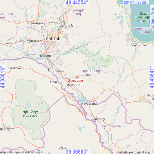
Goravan GPS coordinates[2]
39° 54' 29.952" North, 44° 43' 59.808" East
| Map corner | latitude | longitude |
|---|---|---|
| Upper-left | 40.44554°, | 44.03016° |
| Center: | 39.90832°, | 44.73328° |
| Lower-right: | 39.36685°, | 45.43641° |
| Map W x H: | 119.9×119.9 km | = 74.5×74.5mi |
| max Lat: | 41.24358° ⇑86.6% North |
| Goravan: | 39.90832° |
| min Lat: | ⇓13.4% South 38.90292° |
| min Long | Goravan | max Long |
| 43.74722° | 44.73328° | 46.5446° |
| W 68.5%⇐ | ⇒31.5% E |
Elevation
Elevation of Goravan is 922 m = 3025 ft, and this is 379.5 m = 1245 ft below average elevation for this country.
| Max E: |
2169 m = 7116 ft | 64.6% |
| Avg. | 1301.5 m = 4270 ft | |
| Goravan | 922 m = 3025 ft | |
Min E: |
440 m = 1444 ft | 35.4% |
See also: Armenia elevation on elevation.city.
Geographical zone
Goravan is located in North temperate zone (between Tropic of Cancer and the Arctic Circle). Distance of this Northern Tropic circle is 1831.5 km =1138 mi to South.| Distance of | km | miles | from Goravan |
|---|---|---|---|
| North Pole | 5569.7 | 3460.9 | to North |
| Arctic Circle | 2963.8 | 1841.6 | to North |
| Tropic Cancer | 1831.5 | 1138 | to South |
| Equator | 4437.4 | 2757.3 | to South |


Nearby cities:
15 places around Goravan: (largest is in red/bold)
• Aralez
6.7 km =4.2 mi,  262°
262°
• Ararat
8.9 km =5.5 mi,  195°
195°
• Avshar
8.7 km =5.4 mi,  227°
227°
• Aygavan
6.7 km =4.2 mi, 234°
• Aygepat
12.7 km =7.9 mi,  296°
296°
• Aygezard
12.3 km =7.6 mi,  294°
294°
• Lusarrat
13.1 km =8.1 mi,  253°
253°
• Noyakert
10.2 km =6.3 mi,  212°
212°
• Shahumyan
14.2 km =8.8 mi, 285°
• Sisavan
5.6 km =3.5 mi,  269°
269°
• Surenavan
13.2 km =8.2 mi,  164°
164°
• Vedi
0.9 km =0.6 mi,  311°
311°
• Verin Artashat
15.8 km =9.8 mi, 308°
• Vosketap’
7.8 km =4.8 mi, 247°
• Yeghegnavan
12.4 km =7.7 mi, 231°
Sources, notices
• [Note1] Compared only with cities in Armenia existing in our database
• [Src1] Map data: © OpenStreetMap contributors (CC-BY-SA)
• [Src2] Other city data from geonames.org with taken over terms of usage.
• [Src3] Geographical zone / Annual Mean Temperature by Robert A. Rohde @ Wikipedia
