Tsovasar geodata
Tsovasar (Gegharkunik) is a populated place; located in Armenia in Asia/Yerevan (GMT+4) time zone. With population of 2,248 people, there are 131 cities with bigger population in this country. Compared to other cities in Armenia, 61.5% of cities are located further ↑North; 82.5% of cities are located further ←West and 98.1% of cities have lower elevation than Tsovasar. Note1


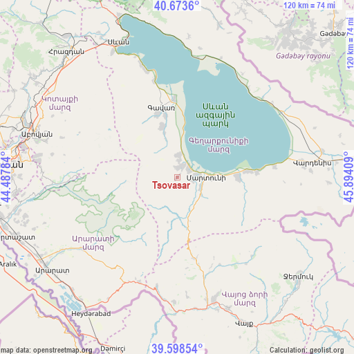
Tsovasar GPS coordinates[2]
40° 8' 17.52" North, 45° 11' 27.456" East
| Map corner | latitude | longitude |
|---|---|---|
| Upper-left | 40.6736°, | 44.48784° |
| Center: | 40.1382°, | 45.19096° |
| Lower-right: | 39.59854°, | 45.89409° |
| Map W x H: | 119.5×119.5 km | = 74.3×74.3mi |
| max Lat: | 41.24358° ⇑61.5% North |
| Tsovasar: | 40.1382° |
| min Lat: | ⇓38.5% South 38.90292° |
| min Long | Tsovasar | max Long |
| 43.74722° | 45.19096° | 46.5446° |
| W 82.5%⇐ | ⇒17.5% E |
Elevation
Elevation of Tsovasar is 2100 m = 6890 ft, and this is 798.5 m = 2620 ft above average elevation for this country.
| Max E: |
2169 m = 7116 ft | 1.9% |
| Tsovasar | 2100 m 6890 ft | |
| Avg. | 1301.5 m = 4270 ft | |
Min E: |
440 m = 1444 ft | 98.1% |
See also: Armenia elevation on elevation.city.
Geographical zone
Tsovasar is located in North temperate zone (between Tropic of Cancer and the Arctic Circle). Distance of this Northern Tropic circle is 1857 km =1153.9 mi to South.| Distance of | km | miles | from Tsovasar |
|---|---|---|---|
| North Pole | 5544.1 | 3444.9 | to North |
| Arctic Circle | 2938.2 | 1825.7 | to North |
| Tropic Cancer | 1857 | 1153.9 | to South |
| Equator | 4462.9 | 2773.1 | to South |


Nearby cities:
15 places around Tsovasar: (largest is in red/bold)
• Astghadzor
14.1 km =8.8 mi,  97°
97°
• Dzoragyugh
3.5 km =2.2 mi,  349°
349°
• Gandzak
20.8 km =12.9 mi,  341°
341°
• Karanlukh
9.2 km =5.7 mi,  114°
114°
• Lanjaghbyur
15.1 km =9.4 mi, 344°
• Lichk’
4.4 km =2.7 mi,  57°
57°
• Madina
8.8 km =5.5 mi,  141°
141°
• Martuni
9.7 km =6 mi,  89°
89°
• Nerk’in Getashen
6.8 km =4.2 mi, 86°
• Sarukhan
17.8 km =11.1 mi, 343°
• Vaghashen
11.9 km =7.4 mi, 91°
• Vardadzor
5.4 km =3.4 mi,  1°
1°
• Vardenik
21.4 km =13.3 mi, 91°
• Verin Getashen
5.3 km =3.3 mi, 99°
• Yeranos
7.3 km =4.5 mi, 0°
Sources, notices
• [Note1] Compared only with cities in Armenia existing in our database
• [Src1] Map data: © OpenStreetMap contributors (CC-BY-SA)
• [Src2] Other city data from geonames.org with taken over terms of usage.
• [Src3] Geographical zone / Annual Mean Temperature by Robert A. Rohde @ Wikipedia
