Vardadzor geodata
Vardadzor (Yerevan) is a populated place; located in Armenia in Asia/Yerevan (GMT+4) time zone. With population of 2,095 people, there are 148 cities with bigger population in this country. Compared to other cities in Armenia, 51.6% of cities are located further ↑North; 83.1% of cities are located further ←West and 96.2% of cities have lower elevation than Vardadzor. Note1


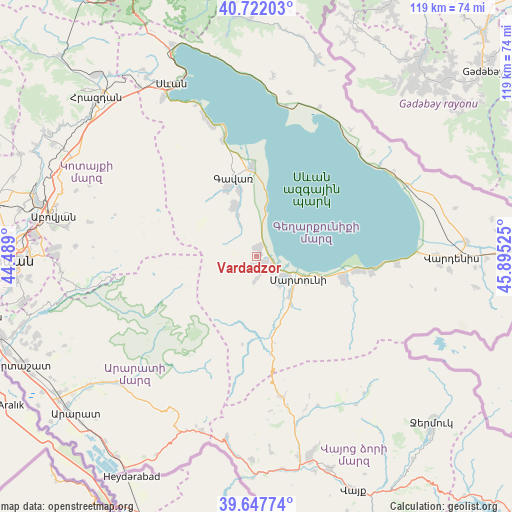
Vardadzor GPS coordinates[2]
40° 11' 13.236" North, 45° 11' 31.632" East
| Map corner | latitude | longitude |
|---|---|---|
| Upper-left | 40.72203°, | 44.489° |
| Center: | 40.18701°, | 45.19212° |
| Lower-right: | 39.64774°, | 45.89525° |
| Map W x H: | 119.4×119.4 km | = 74.2×74.2mi |
| max Lat: | 41.24358° ⇑51.6% North |
| Vardadzor: | 40.18701° |
| min Lat: | ⇓48.4% South 38.90292° |
| min Long | Vardadzor | max Long |
| 43.74722° | 45.19212° | 46.5446° |
| W 83.1%⇐ | ⇒16.9% E |
Elevation
Elevation of Vardadzor is 1997 m = 6552 ft, and this is 695.5 m = 2282 ft above average elevation for this country.
| Max E: |
2169 m = 7116 ft | 3.8% |
| Vardadzor | 1997 m 6552 ft | |
| Avg. | 1301.5 m = 4270 ft | |
Min E: |
440 m = 1444 ft | 96.2% |
See also: Armenia elevation on elevation.city.
Geographical zone
Vardadzor is located in North temperate zone (between Tropic of Cancer and the Arctic Circle). Distance of this Northern Tropic circle is 1862.5 km =1157.3 mi to South.| Distance of | km | miles | from Vardadzor |
|---|---|---|---|
| North Pole | 5538.7 | 3441.6 | to North |
| Arctic Circle | 2932.8 | 1822.4 | to North |
| Tropic Cancer | 1862.5 | 1157.3 | to South |
| Equator | 4468.4 | 2776.5 | to South |


Nearby cities:
15 places around Vardadzor: (largest is in red/bold)
• Astghadzor
15.6 km =9.7 mi,  117°
117°
• Dzoragyugh
2.1 km =1.3 mi,  200°
200°
• Gandzak
15.8 km =9.8 mi,  334°
334°
• Gavarr
19.4 km =12.1 mi,  342°
342°
• Karanlukh
12.4 km =7.7 mi,  137°
137°
• Lanjaghbyur
10 km =6.2 mi, 336°
• Lichk’
4.7 km =2.9 mi,  130°
130°
• Madina
13.4 km =8.3 mi,  156°
156°
• Martuni
11 km =6.8 mi, 119°
• Nerk’in Getashen
8.4 km =5.2 mi, 126°
• Sarukhan
12.8 km =8 mi, 335°
• Tsovasar
5.4 km =3.4 mi,  181°
181°
• Vaghashen
13.1 km =8.1 mi, 115°
• Verin Getashen
8.1 km =5 mi, 140°
• Yeranos
1.9 km =1.2 mi,  359°
359°
Sources, notices
• [Note1] Compared only with cities in Armenia existing in our database
• [Src1] Map data: © OpenStreetMap contributors (CC-BY-SA)
• [Src2] Other city data from geonames.org with taken over terms of usage.
• [Src3] Geographical zone / Annual Mean Temperature by Robert A. Rohde @ Wikipedia
