Lerrnapat geodata
Lerrnapat (Lori) is a populated place; located in Armenia in Asia/Yerevan (GMT+4) time zone. With population of 1,710 people, there are 197 cities with bigger population in this country. Compared to other cities in Armenia, 85.7% of cities are located further ↓South; 62.7% of cities are located further →East and 65.3% of cities have lower elevation than Lerrnapat. Note1


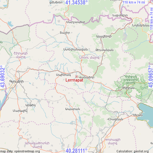
Lerrnapat GPS coordinates[2]
40° 48' 55.368" North, 44° 23' 36.384" East
| Map corner | latitude | longitude |
|---|---|---|
| Upper-left | 41.34538°, | 43.69032° |
| Center: | 40.81538°, | 44.39344° |
| Lower-right: | 40.28111°, | 45.09657° |
| Map W x H: | 118.3×118.3 km | = 73.5×73.5mi |
| max Lat: | 41.24358° ⇑14.3% North |
| Lerrnapat: | 40.81538° |
| min Lat: | ⇓85.7% South 38.90292° |
| min Long | Lerrnapat | max Long |
| 43.74722° | 44.39344° | 46.5446° |
| W 37.3%⇐ | ⇒62.7% E |
Elevation
Elevation of Lerrnapat is 1524 m = 5000 ft, and this is 222.5 m = 730 ft above average elevation for this country.
| Max E: |
2169 m = 7116 ft | 34.7% |
| Lerrnapat | 1524 m 5000 ft | |
| Avg. | 1301.5 m = 4270 ft | |
Min E: |
440 m = 1444 ft | 65.3% |
See also: Armenia elevation on elevation.city.
Geographical zone
Lerrnapat is located in North temperate zone (between Tropic of Cancer and the Arctic Circle). Distance of this Northern Tropic circle is 1932.3 km =1200.7 mi to South.| Distance of | km | miles | from Lerrnapat |
|---|---|---|---|
| North Pole | 5468.8 | 3398.2 | to North |
| Arctic Circle | 2862.9 | 1778.9 | to North |
| Tropic Cancer | 1932.3 | 1200.7 | to South |
| Equator | 4538.2 | 2819.9 | to South |


Nearby cities:
15 places around Lerrnapat: (largest is in red/bold)
• Arevashogh
11.2 km =7 mi,  296°
296°
• Bazum
7 km =4.3 mi,  33°
33°
• Darpas
3.6 km =2.2 mi,  48°
48°
• Gogaran
18.5 km =11.5 mi, 297°
• Gugark’
12.4 km =7.7 mi,  95°
95°
• Gyulagarak
18.1 km =11.2 mi,  21°
21°
• Jrashen
17.6 km =10.9 mi,  260°
260°
• Lerrnants’k’
10.3 km =6.4 mi, 257°
• Lerrnavan
19.9 km =12.4 mi, 261°
• Sarahart’
16.3 km =10.1 mi,  292°
292°
• Saramej
15.1 km =9.4 mi,  252°
252°
• Shahumyan
13.6 km =8.5 mi,  109°
109°
• Spitak
10.8 km =6.7 mi,  280°
280°
• Vanadzor
8.5 km =5.3 mi, 98°
• Vardablur
19.8 km =12.3 mi, 29°
Sources, notices
• [Note1] Compared only with cities in Armenia existing in our database
• [Src1] Map data: © OpenStreetMap contributors (CC-BY-SA)
• [Src2] Other city data from geonames.org with taken over terms of usage.
• [Src3] Geographical zone / Annual Mean Temperature by Robert A. Rohde @ Wikipedia
