Vanadzor geodata
Vanadzor (Lori) is a seat of a first-order administrative division; located in Armenia in Asia/Yerevan (GMT+4) time zone. With population of 101,098 people, there are 2 cities with bigger population in this country. Compared to other cities in Armenia, 85% of cities are located further ↓South; 53.8% of cities are located further →East and 52.9% of cities have lower elevation than Vanadzor. Note1


Vanadzor GPS coordinates[2]
40° 48' 16.416" North, 44° 29' 38.04" East
| Map corner | latitude | longitude |
|---|---|---|
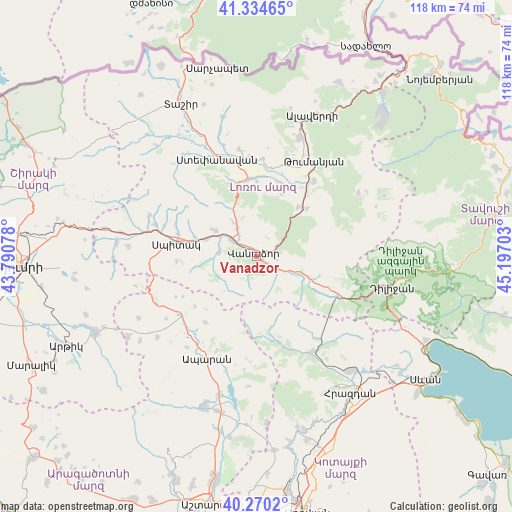
| Upper-left | 41.33465°, | 43.79078° |
| Center: | 40.80456°, | 44.4939° |
| Lower-right: | 40.2702°, | 45.19703° |
| Map W x H: | 118.4×118.4 km | = 73.6×73.6mi |
| max Lat: | 41.24358° ⇑15% North |
| Vanadzor: | 40.80456° |
| min Lat: | ⇓85% South 38.90292° |
| min Long | Vanadzor | max Long |
| 43.74722° | 44.4939° | 46.5446° |
| W 46.2%⇐ | ⇒53.8% E |
Elevation
Elevation of Vanadzor is 1344 m = 4409 ft, and this is 42.5 m = 139 ft above average elevation for this country.
| Max E: |
2169 m = 7116 ft | 47.1% |
| Vanadzor | 1344 m 4409 ft | |
| Avg. | 1301.5 m = 4270 ft | |
Min E: |
440 m = 1444 ft | 52.9% |
See also: Vanadzor elevation on elevation.city.
Geographical zone
Vanadzor is located in North temperate zone (between Tropic of Cancer and the Arctic Circle). Distance of this Northern Tropic circle is 1931.1 km =1199.9 mi to South.| Distance of | km | miles | from Vanadzor |
|---|---|---|---|
| North Pole | 5470 | 3398.9 | to North |
| Arctic Circle | 2864.1 | 1779.7 | to North |
| Tropic Cancer | 1931.1 | 1199.9 | to South |
| Equator | 4537 | 2819.2 | to South |


Nearby cities:
15 places around Vanadzor: (largest is in red/bold)
• Arevashogh
19.5 km =12.1 mi,  288°
288°
• Bazum
8.4 km =5.2 mi,  327°
327°
• Darpas
6.8 km =4.2 mi,  301°
301°
• Dsegh
21.9 km =13.6 mi,  36°
36°
• Fioletovo
20.9 km =13 mi,  115°
115°
• Gugark’
3.9 km =2.4 mi,  89°
89°
• Gyulagarak
18.2 km =11.3 mi,  354°
354°
• Lerrnants’k’
18.5 km =11.5 mi,  266°
266°
• Lerrnapat
8.5 km =5.3 mi,  278°
278°
• Margahovit
17.9 km =11.1 mi, 116°
• Shahumyan
5.5 km =3.4 mi,  127°
127°
• Spitak
19.3 km =12 mi, 279°
• Vahagni
14.9 km =9.3 mi, 40°
• Vardablur
18.5 km =11.5 mi,  3°
3°
• Yeghegnut
15.9 km =9.9 mi,  46°
46°
Sources, notices
• [Note1] Compared only with cities in Armenia existing in our database
• [Src1] Map data: © OpenStreetMap contributors (CC-BY-SA)
• [Src2] Other city data from geonames.org with taken over terms of usage.
• [Src3] Geographical zone / Annual Mean Temperature by Robert A. Rohde @ Wikipedia
