Karchaghbyur geodata
Karchaghbyur (Gegharkunik) is a populated place; located in Armenia in Asia/Yerevan (GMT+4) time zone. With population of 2,274 people, there are 130 cities with bigger population in this country. Compared to other cities in Armenia, 54.8% of cities are located further ↑North; 93% of cities are located further ←West and 91.7% of cities have lower elevation than Karchaghbyur. Note1


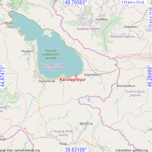
Karchaghbyur GPS coordinates[2]
40° 10' 13.728" North, 45° 34' 40.26" East
| Map corner | latitude | longitude |
|---|---|---|
| Upper-left | 40.70563°, | 44.87473° |
| Center: | 40.17048°, | 45.57785° |
| Lower-right: | 39.63108°, | 46.28098° |
| Map W x H: | 119.5×119.5 km | = 74.3×74.3mi |
| max Lat: | 41.24358° ⇑54.8% North |
| Karchaghbyur: | 40.17048° |
| min Lat: | ⇓45.2% South 38.90292° |
| min Long | Karchaghbyur | max Long |
| 43.74722° | 45.57785° | 46.5446° |
| W 93%⇐ | ⇒7% E |
Elevation
Elevation of Karchaghbyur is 1950 m = 6398 ft, and this is 648.5 m = 2128 ft above average elevation for this country.
| Max E: |
2169 m = 7116 ft | 8.3% |
| Karchaghbyur | 1950 m 6398 ft | |
| Avg. | 1301.5 m = 4270 ft | |
Min E: |
440 m = 1444 ft | 91.7% |
See also: Armenia elevation on elevation.city.
Geographical zone
Karchaghbyur is located in North temperate zone (between Tropic of Cancer and the Arctic Circle). Distance of this Northern Tropic circle is 1860.6 km =1156.1 mi to South.| Distance of | km | miles | from Karchaghbyur |
|---|---|---|---|
| North Pole | 5540.5 | 3442.7 | to North |
| Arctic Circle | 2934.6 | 1823.5 | to North |
| Tropic Cancer | 1860.6 | 1156.1 | to South |
| Equator | 4466.5 | 2775.4 | to South |


Nearby cities:
15 places around Karchaghbyur: (largest is in red/bold)
• Akunk’
12.6 km =7.8 mi,  95°
95°
• Astghadzor
19.6 km =12.2 mi,  254°
254°
• Geghamasar
17.8 km =11.1 mi,  28°
28°
• Karanlukh
25.6 km =15.9 mi, 253°
• Lichk’
29.2 km =18.1 mi,  267°
267°
• Madina
29.4 km =18.3 mi, 249°
• Martuni
23.4 km =14.5 mi,  261°
261°
• Mets Masrik
16.7 km =10.4 mi,  70°
70°
• Nerk’in Getashen
26.3 km =16.3 mi, 263°
• Tsovak
4.9 km =3 mi, 73°
• Tsovinar
9.4 km =5.8 mi, 262°
• Vaghashen
21.3 km =13.2 mi, 259°
• Vardenik
12.2 km =7.6 mi, 250°
• Vardenis
13 km =8.1 mi,  83°
83°
• Verin Getashen
28 km =17.4 mi, 260°
Sources, notices
• [Note1] Compared only with cities in Armenia existing in our database
• [Src1] Map data: © OpenStreetMap contributors (CC-BY-SA)
• [Src2] Other city data from geonames.org with taken over terms of usage.
• [Src3] Geographical zone / Annual Mean Temperature by Robert A. Rohde @ Wikipedia
