Akunk’ geodata
Akunk’ (Gegharkunik) is a populated place; located in Armenia in Asia/Yerevan (GMT+4) time zone. With population of 3,444 people, there are 79 cities with bigger population in this country. Compared to other cities in Armenia, 57% of cities are located further ↑North; 94.3% of cities are located further ←West and 92.7% of cities have lower elevation than Akunk’. Note1


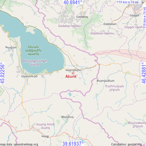
Akunk’ GPS coordinates[2]
40° 9' 31.896" North, 45° 43' 32.448" East
| Map corner | latitude | longitude |
|---|---|---|
| Upper-left | 40.6941°, | 45.02256° |
| Center: | 40.15886°, | 45.72568° |
| Lower-right: | 39.61937°, | 46.42881° |
| Map W x H: | 119.5×119.5 km | = 74.3×74.3mi |
| max Lat: | 41.24358° ⇑57% North |
| Akunk’: | 40.15886° |
| min Lat: | ⇓43% South 38.90292° |
| min Long | Akunk’ | max Long |
| 43.74722° | 45.72568° | 46.5446° |
| W 94.3%⇐ | ⇒5.7% E |
Elevation
Elevation of Akunk’ is 1961 m = 6434 ft, and this is 659.5 m = 2164 ft above average elevation for this country.
| Max E: |
2169 m = 7116 ft | 7.3% |
| Akunk’ | 1961 m 6434 ft | |
| Avg. | 1301.5 m = 4270 ft | |
Min E: |
440 m = 1444 ft | 92.7% |
See also: Armenia elevation on elevation.city.
Geographical zone
Akunk’ is located in North temperate zone (between Tropic of Cancer and the Arctic Circle). Distance of this Northern Tropic circle is 1859.3 km =1155.3 mi to South.| Distance of | km | miles | from Akunk’ |
|---|---|---|---|
| North Pole | 5541.8 | 3443.5 | to North |
| Arctic Circle | 2935.9 | 1824.3 | to North |
| Tropic Cancer | 1859.3 | 1155.3 | to South |
| Equator | 4465.2 | 2774.5 | to South |


Nearby cities:
15 places around Akunk’: (largest is in red/bold)
• Astghadzor
31.7 km =19.7 mi,  262°
262°
• Geghamasar
17.4 km =10.8 mi,  346°
346°
• Jermuk
35.6 km =22.1 mi,  187°
187°
• Karanlukh
37.6 km =23.4 mi, 260°
• Karchaghbyur
12.6 km =7.8 mi,  275°
275°
• Madina
41.1 km =25.5 mi, 257°
• Martuni
35.8 km =22.2 mi,  266°
266°
• Mets Masrik
7.5 km =4.7 mi,  25°
25°
• Nerk’in Getashen
38.7 km =24 mi, 267°
• Tsovak
8.3 km =5.2 mi,  288°
288°
• Tsovinar
21.9 km =13.6 mi, 270°
• Vaghashen
33.7 km =20.9 mi, 265°
• Vardenik
24.2 km =15 mi, 263°
• Vardenis
2.7 km =1.7 mi,  8°
8°
• Verin Getashen
40.3 km =25 mi, 265°
Sources, notices
• [Note1] Compared only with cities in Armenia existing in our database
• [Src1] Map data: © OpenStreetMap contributors (CC-BY-SA)
• [Src2] Other city data from geonames.org with taken over terms of usage.
• [Src3] Geographical zone / Annual Mean Temperature by Robert A. Rohde @ Wikipedia
