Dzit’hank’ov geodata
Dzit’hank’ov (Shirak) is a populated place; located in Armenia in Asia/Yerevan (GMT+4) time zone. With population of 1,162 people, there are 273 cities with bigger population in this country. Compared to other cities in Armenia, 68.5% of cities are located further ↓South; 97.8% of cities are located further →East and 77.4% of cities have lower elevation than Dzit’hank’ov. Note1


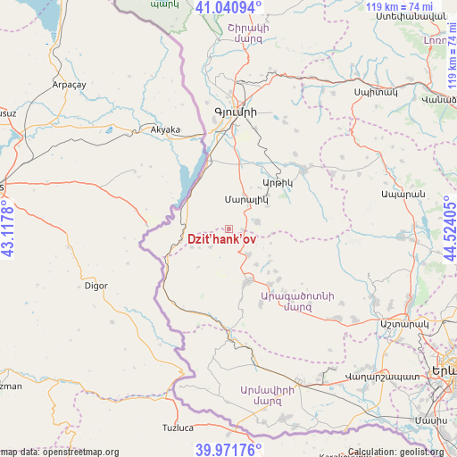
Dzit’hank’ov GPS coordinates[2]
40° 30' 30.528" North, 43° 49' 15.312" East
| Map corner | latitude | longitude |
|---|---|---|
| Upper-left | 41.04094°, | 43.1178° |
| Center: | 40.50848°, | 43.82092° |
| Lower-right: | 39.97176°, | 44.52405° |
| Map W x H: | 118.9×118.9 km | = 73.9×73.9mi |
| max Lat: | 41.24358° ⇑31.5% North |
| Dzit’hank’ov: | 40.50848° |
| min Lat: | ⇓68.5% South 38.90292° |
| min Long | Dzit’hank’o | max Long |
| 43.74722° | 43.82092° | 46.5446° |
| W 2.2%⇐ | ⇒97.8% E |
Elevation
Elevation of Dzit’hank’ov is 1751 m = 5745 ft, and this is 449.5 m = 1475 ft above average elevation for this country.
| Max E: |
2169 m = 7116 ft | 22.6% |
| Dzit’hank’ov | 1751 m 5745 ft | |
| Avg. | 1301.5 m = 4270 ft | |
Min E: |
440 m = 1444 ft | 77.4% |
See also: Armenia elevation on elevation.city.
Geographical zone
Dzit’hank’ov is located in North temperate zone (between Tropic of Cancer and the Arctic Circle). Distance of this Northern Tropic circle is 1898.2 km =1179.5 mi to South.| Distance of | km | miles | from Dzit’hank’ov |
|---|---|---|---|
| North Pole | 5502.9 | 3419.3 | to North |
| Arctic Circle | 2897.1 | 1800.2 | to North |
| Tropic Cancer | 1898.2 | 1179.5 | to South |
| Equator | 4504.1 | 2798.7 | to South |


Nearby cities:
15 places around Dzit’hank’ov: (largest is in red/bold)
• Anushavan
20.7 km =12.9 mi,  40°
40°
• Arevshat
24.8 km =15.4 mi,  49°
49°
• Arteni
23.9 km =14.9 mi,  191°
191°
• Ashnak
21.4 km =13.3 mi,  157°
157°
• Azatan
23.5 km =14.6 mi,  1°
1°
• Horrom
17.8 km =11.1 mi,  19°
19°
• Lerrnakert
11.6 km =7.2 mi,  58°
58°
• Maralik
8.6 km =5.3 mi,  30°
30°
• Meghrashen
21.6 km =13.4 mi, 32°
• Pemzashen
13.5 km =8.4 mi, 50°
• P’ok’r Mant’ash
24 km =14.9 mi, 52°
• Saratak
18.6 km =11.6 mi,  13°
13°
• Spandaryan
23.6 km =14.7 mi, 44°
• T’alin
13.8 km =8.6 mi, 159°
• Yerazgavors
21.7 km =13.5 mi,  343°
343°
Sources, notices
• [Note1] Compared only with cities in Armenia existing in our database
• [Src1] Map data: © OpenStreetMap contributors (CC-BY-SA)
• [Src2] Other city data from geonames.org with taken over terms of usage.
• [Src3] Geographical zone / Annual Mean Temperature by Robert A. Rohde @ Wikipedia
