T’alin geodata
T’alin (Aragatsotn) is a populated place; located in Armenia in Asia/Yerevan (GMT+4) time zone. With population of 4,945 people, there are 44 cities with bigger population in this country. Compared to other cities in Armenia, 64.3% of cities are located further ↓South; 95.9% of cities are located further →East and 71.3% of cities have lower elevation than T’alin. Note1


T’alin GPS coordinates[2]
40° 23' 30.192" North, 43° 52' 40.548" East
| Map corner | latitude | longitude |
|---|---|---|
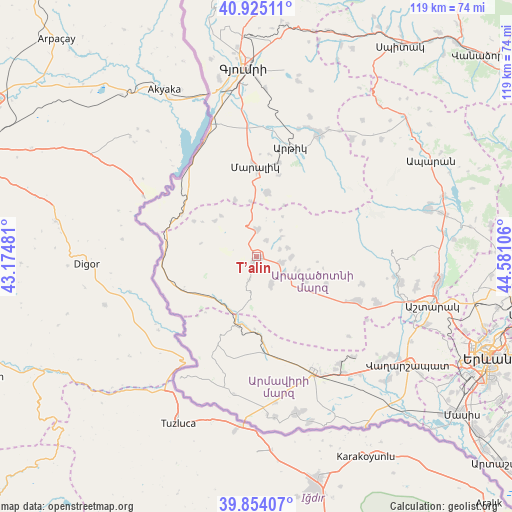
| Upper-left | 40.92511°, | 43.17481° |
| Center: | 40.39172°, | 43.87793° |
| Lower-right: | 39.85407°, | 44.58106° |
| Map W x H: | 119.1×119.1 km | = 74×74mi |
| max Lat: | 41.24358° ⇑35.7% North |
| T’alin: | 40.39172° |
| min Lat: | ⇓64.3% South 38.90292° |
| min Long | T’alin | max Long |
| 43.74722° | 43.87793° | 46.5446° |
| W 4.1%⇐ | ⇒95.9% E |
Elevation
Elevation of T’alin is 1631 m = 5351 ft, and this is 329.5 m = 1081 ft above average elevation for this country.
| Max E: |
2169 m = 7116 ft | 28.7% |
| T’alin | 1631 m 5351 ft | |
| Avg. | 1301.5 m = 4270 ft | |
Min E: |
440 m = 1444 ft | 71.3% |
See also: Armenia elevation on elevation.city.
Geographical zone
T’alin is located in North temperate zone (between Tropic of Cancer and the Arctic Circle). Distance of this Northern Tropic circle is 1885.2 km =1171.4 mi to South.| Distance of | km | miles | from T’alin |
|---|---|---|---|
| North Pole | 5515.9 | 3427.4 | to North |
| Arctic Circle | 2910 | 1808.2 | to North |
| Tropic Cancer | 1885.2 | 1171.4 | to South |
| Equator | 4491.1 | 2790.6 | to South |


Nearby cities:
15 places around T’alin: (largest is in red/bold)
• Agarakavan
17.8 km =11.1 mi,  112°
112°
• Anushavan
30 km =18.6 mi,  16°
16°
• Armavir
29.7 km =18.5 mi,  152°
152°
• Arteni
14.1 km =8.8 mi,  221°
221°
• Ashnak
7.5 km =4.7 mi, 154°
• Dalarik
18.2 km =11.3 mi,  180°
180°
• Dzit’hank’ov
13.8 km =8.6 mi,  339°
339°
• Horrom
29.8 km =18.5 mi,  2°
2°
• Kosh
26.1 km =16.2 mi, 113°
• Lenughi
30.5 km =19 mi,  166°
166°
• Lerrnakert
19.7 km =12.2 mi, 15°
• Lukashin
25.1 km =15.6 mi, 154°
• Maralik
20.4 km =12.7 mi,  358°
358°
• Myasnikyan
23.8 km =14.8 mi, 171°
• Pemzashen
22.3 km =13.9 mi,  14°
14°
Sources, notices
• [Note1] Compared only with cities in Armenia existing in our database
• [Src1] Map data: © OpenStreetMap contributors (CC-BY-SA)
• [Src2] Other city data from geonames.org with taken over terms of usage.
• [Src3] Geographical zone / Annual Mean Temperature by Robert A. Rohde @ Wikipedia
