Artsvaberd geodata
Artsvaberd (Tavush) is a populated place; located in Armenia in Asia/Yerevan (GMT+4) time zone. With population of 3,193 people, there are 85 cities with bigger population in this country. Compared to other cities in Armenia, 87.6% of cities are located further ↓South; 92% of cities are located further ←West and 50.6% of cities have higher elevation than Artsvaberd. Note1


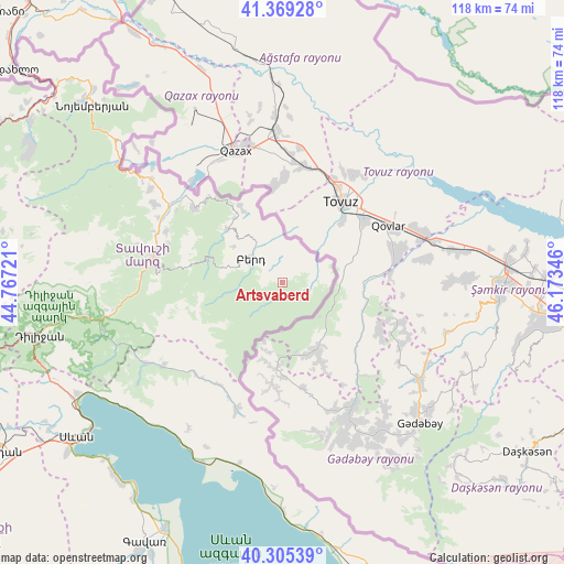
Artsvaberd GPS coordinates[2]
40° 50' 22.092" North, 45° 28' 13.188" East
| Map corner | latitude | longitude |
|---|---|---|
| Upper-left | 41.36928°, | 44.76721° |
| Center: | 40.83947°, | 45.47033° |
| Lower-right: | 40.30539°, | 46.17346° |
| Map W x H: | 118.3×118.3 km | = 73.5×73.5mi |
| max Lat: | 41.24358° ⇑12.4% North |
| Artsvaberd: | 40.83947° |
| min Lat: | ⇓87.6% South 38.90292° |
| min Long | Artsvaberd | max Long |
| 43.74722° | 45.47033° | 46.5446° |
| W 92%⇐ | ⇒8% E |
Elevation
Elevation of Artsvaberd is 1285 m = 4216 ft, and this is 16.5 m = 54 ft below average elevation for this country.
| Max E: |
2169 m = 7116 ft | 50.6% |
| Avg. | 1301.5 m = 4270 ft | |
| Artsvaberd | 1285 m = 4216 ft | |
Min E: |
440 m = 1444 ft | 49.4% |
See also: Armenia elevation on elevation.city.
Geographical zone
Artsvaberd is located in North temperate zone (between Tropic of Cancer and the Arctic Circle). Distance of this Northern Tropic circle is 1935 km =1202.4 mi to South.| Distance of | km | miles | from Artsvaberd |
|---|---|---|---|
| North Pole | 5466.1 | 3396.5 | to North |
| Arctic Circle | 2860.3 | 1777.3 | to North |
| Tropic Cancer | 1935 | 1202.4 | to South |
| Equator | 4540.9 | 2821.6 | to South |


Nearby cities:
15 places around Artsvaberd: (largest is in red/bold)
• Aygehovit
24.2 km =15 mi,  310°
310°
• Aygut
30.3 km =18.8 mi,  234°
234°
• Azatamut
28.7 km =17.8 mi,  303°
303°
• Berd
8.3 km =5.2 mi, 304°
• Chambarak
28.7 km =17.8 mi,  199°
199°
• Drakhtik
36.3 km =22.6 mi,  212°
212°
• Gosh
41.4 km =25.7 mi,  252°
252°
• Haghartsin
42.8 km =26.6 mi,  260°
260°
• Ijevan
27.4 km =17 mi,  279°
279°
• Khasht’arrak
26.5 km =16.5 mi,  294°
294°
• Mosesgegh
7.5 km =4.7 mi,  11°
11°
• Navur
11.2 km =7 mi, 285°
• Parravak’ar
18.1 km =11.2 mi,  331°
331°
• Sarigyugh
35 km =21.7 mi, 308°
• Vahan
30 km =18.6 mi,  191°
191°
Sources, notices
• [Note1] Compared only with cities in Armenia existing in our database
• [Src1] Map data: © OpenStreetMap contributors (CC-BY-SA)
• [Src2] Other city data from geonames.org with taken over terms of usage.
• [Src3] Geographical zone / Annual Mean Temperature by Robert A. Rohde @ Wikipedia
