Aygut geodata
Aygut (Gegharkunik) is a populated place; located in Armenia in Asia/Yerevan (GMT+4) time zone. With population of 997 people, there are 311 cities with bigger population in this country. Compared to other cities in Armenia, 78.3% of cities are located further ↓South; 80.3% of cities are located further ←West and 57.6% of cities have lower elevation than Aygut. Note1


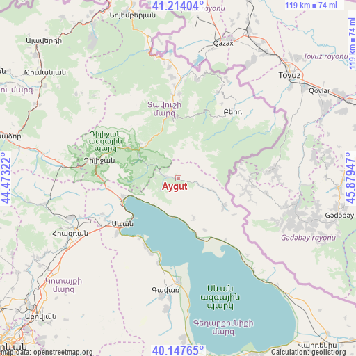
Aygut GPS coordinates[2]
40° 40' 58.728" North, 45° 10' 34.824" East
| Map corner | latitude | longitude |
|---|---|---|
| Upper-left | 41.21404°, | 44.47322° |
| Center: | 40.68298°, | 45.17634° |
| Lower-right: | 40.14765°, | 45.87947° |
| Map W x H: | 118.6×118.6 km | = 73.7×73.7mi |
| max Lat: | 41.24358° ⇑21.7% North |
| Aygut: | 40.68298° |
| min Lat: | ⇓78.3% South 38.90292° |
| min Long | Aygut | max Long |
| 43.74722° | 45.17634° | 46.5446° |
| W 80.3%⇐ | ⇒19.7% E |
Elevation
Elevation of Aygut is 1427 m = 4682 ft, and this is 125.5 m = 412 ft above average elevation for this country.
| Max E: |
2169 m = 7116 ft | 42.4% |
| Aygut | 1427 m 4682 ft | |
| Avg. | 1301.5 m = 4270 ft | |
Min E: |
440 m = 1444 ft | 57.6% |
See also: Armenia elevation on elevation.city.
Geographical zone
Aygut is located in North temperate zone (between Tropic of Cancer and the Arctic Circle). Distance of this Northern Tropic circle is 1917.6 km =1191.5 mi to South.| Distance of | km | miles | from Aygut |
|---|---|---|---|
| North Pole | 5483.5 | 3407.3 | to North |
| Arctic Circle | 2877.7 | 1788.1 | to North |
| Tropic Cancer | 1917.6 | 1191.5 | to South |
| Equator | 4523.5 | 2810.8 | to South |


Nearby cities:
15 places around Aygut: (largest is in red/bold)
• Chambarak
17.9 km =11.1 mi,  122°
122°
• Drakhtik
14.1 km =8.8 mi,  158°
158°
• Geghamavan
27.7 km =17.2 mi,  241°
241°
• Gosh
15.8 km =9.8 mi,  289°
289°
• Haghartsin
20.3 km =12.6 mi,  300°
300°
• Ijevan
21.9 km =13.6 mi,  353°
353°
• Khasht’arrak
28.2 km =17.5 mi,  0°
0°
• Lchap’
26.7 km =16.6 mi,  198°
198°
• Lchashen
27.6 km =17.1 mi,  228°
228°
• Navur
24.7 km =15.3 mi,  34°
34°
• Sevan
24.9 km =15.5 mi, 232°
• Tsovagyugh
19 km =11.8 mi,  253°
253°
• Tsovazard
25.5 km =15.8 mi, 204°
• Vahan
22.2 km =13.8 mi, 122°
• Varser
26.7 km =16.6 mi, 237°
Sources, notices
• [Note1] Compared only with cities in Armenia existing in our database
• [Src1] Map data: © OpenStreetMap contributors (CC-BY-SA)
• [Src2] Other city data from geonames.org with taken over terms of usage.
• [Src3] Geographical zone / Annual Mean Temperature by Robert A. Rohde @ Wikipedia
