Saladas geodata
Saladas (Corrientes) is a seat of a second-order administrative division; located in Argentina in America/Argentina/Cordoba (GMT-3) time zone. With population of 18,349 people, there are 201 cities with bigger population in this country. Compared to other cities in Argentina, 72.8% of cities are located further ↓South; 82% of cities are located further ←West and 72.4% of cities have higher elevation than Saladas. Note1


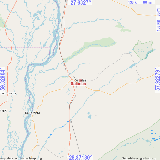
Saladas GPS coordinates[2]
28° 15' 13.824" South, 58° 37' 33.276" West
| Map corner | latitude | longitude |
|---|---|---|
| Upper-left | -27.6327°, | -59.32904° |
| Center: | -28.25384°, | -58.62591° |
| Lower-right: | -28.87139°, | -57.92279° |
| Map W x H: | 137.7×137.7 km | = 85.6×85.6mi |
| max Lat: | -21.94467° ⇑27.2% North |
| Saladas: | -28.25384° |
| min Lat: | ⇓72.8% South -54.81084° |
| min Long | Saladas | max Long |
| -72.88605° | -58.62591° | -53.64581° |
| W 82%⇐ | ⇒18% E |
Elevation
Elevation of Saladas is 75 m = 246 ft, and this is 274.3 m = 900 ft below average elevation for this country.
| Max E: |
4040 m = 13255 ft | 72.4% |
| Avg. | 349.3 m = 1146 ft | |
| Saladas | 75 m = 246 ft | |
Min E: |
-2 m = -7 ft | 27.6% |
See also: Argentina elevation on elevation.city.
Geographical zone
Saladas is located in South temperate zone (between Tropic of Capricorn and the Antarctic Circle). Distance of this Southern Tropic circle is 535.6 km =332.8 mi to North.| Distance of | km | miles | from Saladas |
|---|---|---|---|
| Equator | 3141.5 | 1952 | to North |
| Tropic Capricorn | 535.6 | 332.8 | to North |
| Antarctic Circle | 4259.6 | 2646.8 | to South |
| South Pole | 6865.5 | 4266 | to South |


Nearby cities:
15 places around Saladas: (largest is in red/bold)
• Basail
76.3 km =47.4 mi,  302°
302°
• Bella Vista
49.5 km =30.8 mi,  235°
235°
• Concepción
73.9 km =45.9 mi,  101°
101°
• Cruz de los Milagros
74.6 km =46.4 mi,  209°
209°
• Empedrado
37.9 km =23.5 mi,  332°
332°
• Las Toscas
62.8 km =39 mi,  259°
259°
• Mburucuyá
45.4 km =28.2 mi,  59°
59°
• Nueve de Julio
68.1 km =42.3 mi,  196°
196°
• Pedro R. Fernández
55.4 km =34.4 mi,  183°
183°
• Riachuelo
75.6 km =47 mi,  351°
351°
• San Lorenzo
19.3 km =12 mi,  314°
314°
• San Roque
36.6 km =22.7 mi,  192°
192°
• Santa Rosa
49.7 km =30.9 mi,  91°
91°
• Tacuarendí
64.5 km =40.1 mi,  254°
254°
• Villa Ocampo
75.9 km =47.2 mi, 249°
Sources, notices
• [Note1] Compared only with cities in Argentina existing in our database
• [Src1] Map data: © OpenStreetMap contributors (CC-BY-SA)
• [Src2] Other city data from geonames.org with taken over terms of usage.
• [Src3] Geographical zone / Annual Mean Temperature by Robert A. Rohde @ Wikipedia
