Colonia Carlos Pellegrini geodata
Colonia Carlos Pellegrini (Corrientes) is a populated place; located in Argentina in America/Argentina/Cordoba (GMT-3) time zone. With population of 880 people, there are 776 cities with bigger population in this country. Compared to other cities in Argentina, 71% of cities are located further ↓South; 92.2% of cities are located further ←West and 75.7% of cities have higher elevation than Colonia Carlos Pellegrini. Note1
Current local time in Colonia Carlos Pellegrini:
05:29 AM, SaturdayDifference from your time zone: hours


Colonia Carlos Pellegrini GPS coordinates[2]
28° 32' 8.016" South, 57° 10' 27.66" West
| Map corner | latitude | longitude |
|---|---|---|
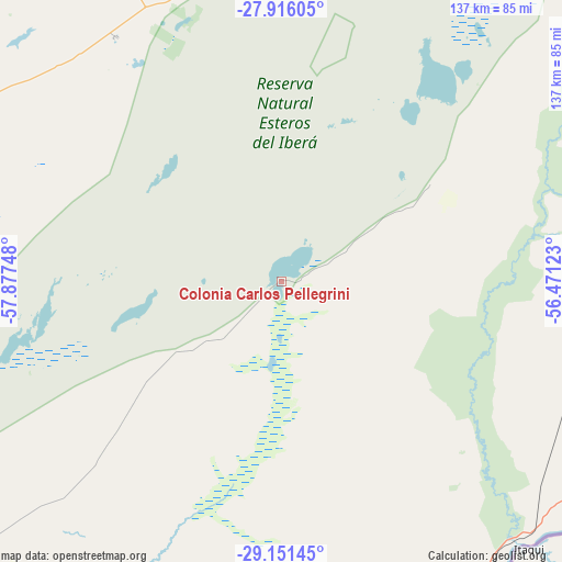
| Upper-left | -27.91605°, | -57.87748° |
| Center: | -28.53556°, | -57.17435° |
| Lower-right: | -29.15145°, | -56.47123° |
| Map W x H: | 137.4×137.4 km | = 85.4×85.4mi |
| max Lat: | -21.94467° ⇑29% North |
| Colonia Carlos Pellegrini: | -28.53556° |
| min Lat: | ⇓71% South -54.81084° |
| min Long | Colonia Carlos | max Long |
| -72.88605° | -57.17435° | -53.64581° |
| W 92.2%⇐ | ⇒7.8% E |
Elevation
Elevation of Colonia Carlos Pellegrini is 68 m = 223 ft, and this is 281.3 m = 923 ft below average elevation for this country.
| Max E: |
4040 m = 13255 ft | 75.7% |
| Avg. | 349.3 m = 1146 ft | |
| Colonia Carlos Pellegrini | 68 m = 223 ft | |
Min E: |
-2 m = -7 ft | 24.3% |
See also: Argentina elevation on elevation.city.
Geographical zone
Colonia Carlos Pellegrini is located in South temperate zone (between Tropic of Capricorn and the Antarctic Circle). Distance of this Southern Tropic circle is 566.9 km =352.3 mi to North.| Distance of | km | miles | from Colonia Carlos Pellegrini |
|---|---|---|---|
| Equator | 3172.9 | 1971.5 | to North |
| Tropic Capricorn | 566.9 | 352.3 | to North |
| Antarctic Circle | 4228.3 | 2627.3 | to South |
| South Pole | 6834.2 | 4246.6 | to South |


Nearby cities:
15 places around Colonia Carlos Pellegrini: (largest is in red/bold)
• Alvear
87.1 km =54.1 mi,  135°
135°
• Berón de Astrada
115.1 km =71.5 mi,  342°
342°
• Concepción
71.5 km =44.4 mi,  282°
282°
• Guaviraví
98.5 km =61.2 mi,  160°
160°
• La Cruz
87.9 km =54.6 mi, 143°
• Lomas de Vallejos
115.1 km =71.5 mi,  320°
320°
• Loreto
85.9 km =53.4 mi,  353°
353°
• Mercedes
113.6 km =70.6 mi,  230°
230°
• Nuestra Señora del Rosario de Caa Catí
97.6 km =60.6 mi,  333°
333°
• Palmar Grande
97 km =60.3 mi,  312°
312°
• San Miguel
72.5 km =45 mi, 325°
• Santa Rosa
97.2 km =60.4 mi,  288°
288°
• Santo Tomé
110.7 km =68.8 mi,  90°
90°
• Tapebicuá
109.6 km =68.1 mi,  169°
169°
• Yapeyú
109.4 km =68 mi, 161°
Sources, notices
• [Note1] Compared only with cities in Argentina existing in our database
• [Src1] Map data: © OpenStreetMap contributors (CC-BY-SA)
• [Src2] Other city data from geonames.org with taken over terms of usage.
• [Src3] Geographical zone / Annual Mean Temperature by Robert A. Rohde @ Wikipedia
