La Paz geodata
La Paz (Entre Rios) is a seat of a second-order administrative division; located in Argentina in America/Argentina/Cordoba (GMT-3) time zone. With population of 24,716 people, there are 163 cities with bigger population in this country. Compared to other cities in Argentina, 61.8% of cities are located further ↓South; 70.8% of cities are located further ←West and 82.6% of cities have higher elevation than La Paz. Note1


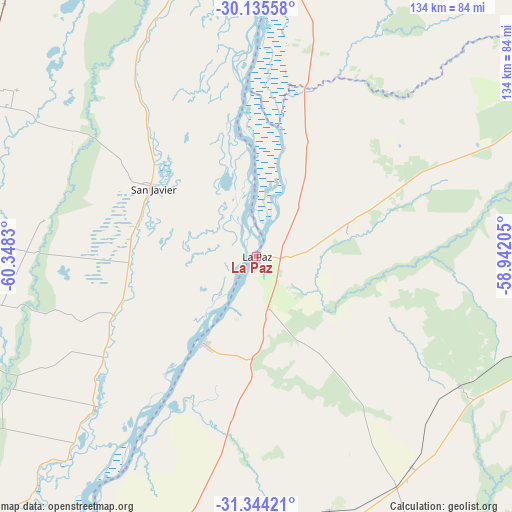
La Paz GPS coordinates[2]
30° 44' 30.444" South, 59° 38' 42.612" West
| Map corner | latitude | longitude |
|---|---|---|
| Upper-left | -30.13558°, | -60.3483° |
| Center: | -30.74179°, | -59.64517° |
| Lower-right: | -31.34421°, | -58.94205° |
| Map W x H: | 134.4×134.4 km | = 83.5×83.5mi |
| max Lat: | -21.94467° ⇑38.2% North |
| La Paz: | -30.74179° |
| min Lat: | ⇓61.8% South -54.81084° |
| min Long | La Paz | max Long |
| -72.88605° | -59.64517° | -53.64581° |
| W 70.8%⇐ | ⇒29.2% E |
Elevation
Elevation of La Paz is 53 m = 174 ft, and this is 296.3 m = 972 ft below average elevation for this country.
| Max E: |
4040 m = 13255 ft | 82.6% |
| Avg. | 349.3 m = 1146 ft | |
| La Paz | 53 m = 174 ft | |
Min E: |
-2 m = -7 ft | 17.4% |
See also: Argentina elevation on elevation.city.
Geographical zone
La Paz is located in South temperate zone (between Tropic of Capricorn and the Antarctic Circle). Distance of this Southern Tropic circle is 812.2 km =504.7 mi to North.| Distance of | km | miles | from La Paz |
|---|---|---|---|
| Equator | 3418.2 | 2124 | to North |
| Tropic Capricorn | 812.2 | 504.7 | to North |
| Antarctic Circle | 3983 | 2474.9 | to South |
| South Pole | 6588.9 | 4094.2 | to South |


Nearby cities:
15 places around La Paz: (largest is in red/bold)
• Bovril
69.5 km =43.2 mi,  164°
164°
• Colonia La Brava
57.7 km =35.9 mi,  304°
304°
• Conscripto Bernardi
63.4 km =39.4 mi,  122°
122°
• Esquina
81.6 km =50.7 mi,  7°
7°
• Federal
85.6 km =53.2 mi,  106°
106°
• Hasenkamp
87.6 km =54.4 mi,  191°
191°
• Helvecia
58 km =36 mi,  226°
226°
• Piedras Blancas
57.4 km =35.7 mi,  210°
210°
• Pueblo Libertador
62.9 km =39.1 mi,  22°
22°
• San Gustavo
24.3 km =15.1 mi,  76°
76°
• San Javier
32.9 km =20.4 mi, 303°
• San Justo
90.6 km =56.3 mi,  266°
266°
• Santa Elena
26.3 km =16.3 mi, 211°
• Sauce de Luna
68.5 km =42.6 mi,  143°
143°
• Villa Hernandarias
63.3 km =39.3 mi, 210°
Sources, notices
• [Note1] Compared only with cities in Argentina existing in our database
• [Src1] Map data: © OpenStreetMap contributors (CC-BY-SA)
• [Src2] Other city data from geonames.org with taken over terms of usage.
• [Src3] Geographical zone / Annual Mean Temperature by Robert A. Rohde @ Wikipedia
