Sauce de Luna geodata
Sauce de Luna (Entre Rios) is a populated place; located in Argentina in America/Argentina/Cordoba (GMT-3) time zone. With population of 2,901 people, there are 559 cities with bigger population in this country. Compared to other cities in Argentina, 57.6% of cities are located further ↓South; 74.4% of cities are located further ←West and 71.7% of cities have higher elevation than Sauce de Luna. Note1


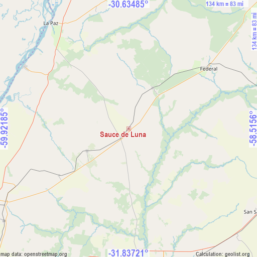
Sauce de Luna GPS coordinates[2]
31° 14' 16.584" South, 59° 13' 7.392" West
| Map corner | latitude | longitude |
|---|---|---|
| Upper-left | -30.63485°, | -59.92185° |
| Center: | -31.23794°, | -59.21872° |
| Lower-right: | -31.83721°, | -58.5156° |
| Map W x H: | 133.7×133.7 km | = 83.1×83.1mi |
| max Lat: | -21.94467° ⇑42.4% North |
| Sauce de Luna: | -31.23794° |
| min Lat: | ⇓57.6% South -54.81084° |
| min Long | Sauce de Luna | max Long |
| -72.88605° | -59.21872° | -53.64581° |
| W 74.4%⇐ | ⇒25.6% E |
Elevation
Elevation of Sauce de Luna is 76 m = 249 ft, and this is 273.3 m = 897 ft below average elevation for this country.
| Max E: |
4040 m = 13255 ft | 71.7% |
| Avg. | 349.3 m = 1146 ft | |
| Sauce de Luna | 76 m = 249 ft | |
Min E: |
-2 m = -7 ft | 28.3% |
See also: Argentina elevation on elevation.city.
Geographical zone
Sauce de Luna is located in South temperate zone (between Tropic of Capricorn and the Antarctic Circle). Distance of this Southern Tropic circle is 867.4 km =539 mi to North.| Distance of | km | miles | from Sauce de Luna |
|---|---|---|---|
| Equator | 3473.3 | 2158.2 | to North |
| Tropic Capricorn | 867.4 | 539 | to North |
| Antarctic Circle | 3927.8 | 2440.6 | to South |
| South Pole | 6533.7 | 4059.9 | to South |


Nearby cities:
15 places around Sauce de Luna: (largest is in red/bold)
• Bovril
24.5 km =15.2 mi,  241°
241°
• Conscripto Bernardi
24.7 km =15.3 mi,  31°
31°
• Domínguez
86.8 km =53.9 mi,  163°
163°
• Federal
52.1 km =32.4 mi,  52°
52°
• General Campos
83.5 km =51.9 mi,  112°
112°
• Hasenkamp
66 km =41 mi, 242°
• Helvecia
84.2 km =52.3 mi,  280°
280°
• La Paz
68.5 km =42.6 mi,  323°
323°
• Piedras Blancas
70 km =43.5 mi,  274°
274°
• San Gustavo
63.3 km =39.3 mi,  344°
344°
• San Salvador
80.2 km =49.8 mi,  122°
122°
• Santa Elena
63.3 km =39.3 mi,  301°
301°
• Villa Hernandarias
72.8 km =45.2 mi, 270°
• Villa María Grande
80.4 km =50 mi,  233°
233°
• Villaguay
72.1 km =44.8 mi,  165°
165°
Sources, notices
• [Note1] Compared only with cities in Argentina existing in our database
• [Src1] Map data: © OpenStreetMap contributors (CC-BY-SA)
• [Src2] Other city data from geonames.org with taken over terms of usage.
• [Src3] Geographical zone / Annual Mean Temperature by Robert A. Rohde @ Wikipedia
