Helvecia geodata
Helvecia (Santa Fe) is a seat of a second-order administrative division; located in Argentina in America/Argentina/Cordoba (GMT-3) time zone. In our database, there are 785 cities with bigger population. Compared to other cities in Argentina, 58.7% of cities are located further ↓South; 67.4% of cities are located further ←West and 91.6% of cities have higher elevation than Helvecia. Note1


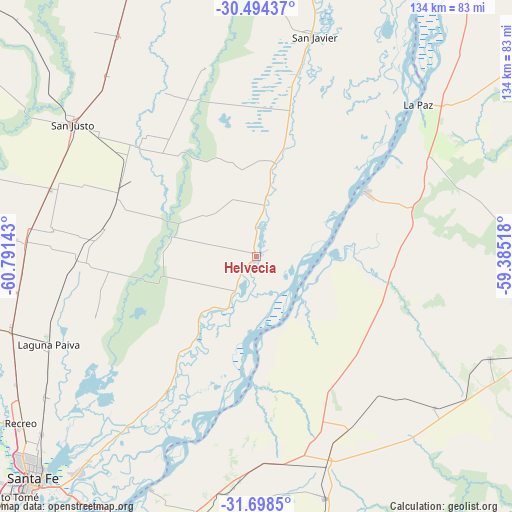
Helvecia GPS coordinates[2]
31° 5' 54.024" South, 60° 5' 17.88" West
| Map corner | latitude | longitude |
|---|---|---|
| Upper-left | -30.49437°, | -60.79143° |
| Center: | -31.09834°, | -60.0883° |
| Lower-right: | -31.6985°, | -59.38518° |
| Map W x H: | 133.9×133.9 km | = 83.2×83.2mi |
| max Lat: | -21.94467° ⇑41.3% North |
| Helvecia: | -31.09834° |
| min Lat: | ⇓58.7% South -54.81084° |
| min Long | Helvecia | max Long |
| -72.88605° | -60.0883° | -53.64581° |
| W 67.4%⇐ | ⇒32.6% E |
Elevation
Elevation of Helvecia is 26 m = 85 ft, and this is 323.3 m = 1061 ft below average elevation for this country.
| Max E: |
4040 m = 13255 ft | 91.6% |
| Avg. | 349.3 m = 1146 ft | |
| Helvecia | 26 m = 85 ft | |
Min E: |
-2 m = -7 ft | 8.4% |
See also: Argentina elevation on elevation.city.
Geographical zone
Helvecia is located in South temperate zone (between Tropic of Capricorn and the Antarctic Circle). Distance of this Southern Tropic circle is 851.9 km =529.3 mi to North.| Distance of | km | miles | from Helvecia |
|---|---|---|---|
| Equator | 3457.8 | 2148.6 | to North |
| Tropic Capricorn | 851.9 | 529.3 | to North |
| Antarctic Circle | 3943.4 | 2450.3 | to South |
| South Pole | 6549.3 | 4069.5 | to South |


Nearby cities:
15 places around Helvecia: (largest is in red/bold)
• Bovril
66.9 km =41.6 mi,  113°
113°
• Colonia La Brava
72.8 km =45.2 mi,  356°
356°
• Hasenkamp
51.9 km =32.2 mi,  152°
152°
• La Paz
58 km =36 mi,  46°
46°
• Laguna Paiva
58.9 km =36.6 mi,  247°
247°
• Piedras Blancas
16.2 km =10.1 mi,  126°
126°
• Recreo
75.2 km =46.7 mi,  234°
234°
• San Gustavo
80 km =49.7 mi,  55°
55°
• San Javier
59.8 km =37.2 mi,  14°
14°
• San Justo
59.1 km =36.7 mi,  305°
305°
• Santa Elena
33.3 km =20.7 mi, 59°
• Tabossi
79.5 km =49.4 mi,  169°
169°
• Villa Hernandarias
17.7 km =11 mi, 146°
• Villa María Grande
65.5 km =40.7 mi,  164°
164°
• Villa Urquiza
66.9 km =41.6 mi,  204°
204°
Sources, notices
• [Note1] Compared only with cities in Argentina existing in our database
• [Src1] Map data: © OpenStreetMap contributors (CC-BY-SA)
• [Src2] Other city data from geonames.org with taken over terms of usage.
• [Src3] Geographical zone / Annual Mean Temperature by Robert A. Rohde @ Wikipedia
