Chajarí geodata
Chajarí (Entre Rios) is a populated place; located in Argentina in America/Argentina/Cordoba (GMT-3) time zone. With population of 30,655 people, there are 136 cities with bigger population in this country. Compared to other cities in Argentina, 61.7% of cities are located further ↓South; 89.1% of cities are located further ←West and 80% of cities have higher elevation than Chajarí. Note1


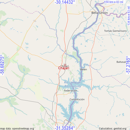
Chajarí GPS coordinates[2]
30° 45' 1.728" South, 57° 58' 46.632" West
| Map corner | latitude | longitude |
|---|---|---|
| Upper-left | -30.14432°, | -58.68275° |
| Center: | -30.75048°, | -57.97962° |
| Lower-right: | -31.35284°, | -57.2765° |
| Map W x H: | 134.4×134.4 km | = 83.5×83.5mi |
| max Lat: | -21.94467° ⇑38.3% North |
| Chajarí: | -30.75048° |
| min Lat: | ⇓61.7% South -54.81084° |
| min Long | Chajarí | max Long |
| -72.88605° | -57.97962° | -53.64581° |
| W 89.1%⇐ | ⇒10.9% E |
Elevation
Elevation of Chajarí is 58 m = 190 ft, and this is 291.3 m = 956 ft below average elevation for this country.
| Max E: |
4040 m = 13255 ft | 80% |
| Avg. | 349.3 m = 1146 ft | |
| Chajarí | 58 m = 190 ft | |
Min E: |
-2 m = -7 ft | 20% |
See also: Argentina elevation on elevation.city.
Geographical zone
Chajarí is located in South temperate zone (between Tropic of Capricorn and the Antarctic Circle). Distance of this Southern Tropic circle is 813.2 km =505.3 mi to North.| Distance of | km | miles | from Chajarí |
|---|---|---|---|
| Equator | 3419.1 | 2124.5 | to North |
| Tropic Capricorn | 813.2 | 505.3 | to North |
| Antarctic Circle | 3982 | 2474.3 | to South |
| South Pole | 6587.9 | 4093.5 | to South |


Nearby cities:
15 places around Chajarí: (largest is in red/bold)
• Concordia
71.5 km =44.4 mi,  183°
183°
• Federación
29.4 km =18.3 mi,  164°
164°
• Federal
80 km =49.7 mi,  253°
253°
• General Campos
95 km =59 mi,  205°
205°
• Juan Pujol
38.7 km =24 mi,  17°
17°
• La Criolla
58.9 km =36.6 mi,  191°
191°
• Libertad
80.1 km =49.8 mi,  10°
10°
• Los Charrúas
51.3 km =31.9 mi,  202°
202°
• Los Conquistadores
49.9 km =31 mi,  290°
290°
• Mocoretá
14.7 km =9.1 mi, 6°
• Monte Caseros
64.3 km =40 mi,  30°
30°
• Puerto Yeruá
87.5 km =54.4 mi, 182°
• San José de Feliciano
84.4 km =52.4 mi,  298°
298°
• Santa Ana
17.2 km =10.7 mi, 164°
• Villa del Rosario
8.1 km =5 mi,  128°
128°
Sources, notices
• [Note1] Compared only with cities in Argentina existing in our database
• [Src1] Map data: © OpenStreetMap contributors (CC-BY-SA)
• [Src2] Other city data from geonames.org with taken over terms of usage.
• [Src3] Geographical zone / Annual Mean Temperature by Robert A. Rohde @ Wikipedia
