Villa Mugueta geodata
Villa Mugueta (Santa Fe) is a populated locality; located in Argentina in America/Argentina/Cordoba (GMT-3) time zone. With population of 2,789 people, there are 570 cities with bigger population in this country. Compared to other cities in Argentina, 65.3% of cities are located further ↑North; 60.8% of cities are located further ←West and 68.1% of cities have higher elevation than Villa Mugueta. Note1


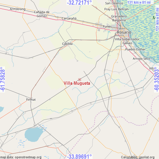
Villa Mugueta GPS coordinates[2]
33° 18' 40.644" South, 61° 3' 18.54" West
| Map corner | latitude | longitude |
|---|---|---|
| Upper-left | -32.72171°, | -61.75828° |
| Center: | -33.31129°, | -61.05515° |
| Lower-right: | -33.89691°, | -60.35203° |
| Map W x H: | 130.7×130.7 km | = 81.2×81.2mi |
| max Lat: | -21.94467° ⇑65.3% North |
| Villa Mugueta: | -33.31129° |
| min Lat: | ⇓34.7% South -54.81084° |
| min Long | Villa Mugueta | max Long |
| -72.88605° | -61.05515° | -53.64581° |
| W 60.8%⇐ | ⇒39.2% E |
Elevation
Elevation of Villa Mugueta is 85 m = 279 ft, and this is 264.3 m = 867 ft below average elevation for this country.
| Max E: |
4040 m = 13255 ft | 68.1% |
| Avg. | 349.3 m = 1146 ft | |
| Villa Mugueta | 85 m = 279 ft | |
Min E: |
-2 m = -7 ft | 31.9% |
See also: Argentina elevation on elevation.city.
Geographical zone
Villa Mugueta is located in South temperate zone (between Tropic of Capricorn and the Antarctic Circle). Distance of this Southern Tropic circle is 1097.9 km =682.2 mi to North.| Distance of | km | miles | from Villa Mugueta |
|---|---|---|---|
| Equator | 3703.9 | 2301.5 | to North |
| Tropic Capricorn | 1097.9 | 682.2 | to North |
| Antarctic Circle | 3697.3 | 2297.4 | to South |
| South Pole | 6303.2 | 3916.6 | to South |


Nearby cities:
15 places around Villa Mugueta: (largest is in red/bold)
• Arroyo Seco
53.7 km =33.4 mi,  71°
71°
• Capitán Bermúdez
62.7 km =39 mi,  29°
29°
• Carcarañá
51.4 km =31.9 mi,  349°
349°
• Casilda
31.5 km =19.6 mi,  340°
340°
• Cañada de Gómez
63.5 km =39.5 mi,  330°
330°
• Colón
65.1 km =40.5 mi,  183°
183°
• Firmat
43 km =26.7 mi,  247°
247°
• Fray Luis A. Beltrán
65.4 km =40.6 mi, 27°
• Funes
49.6 km =30.8 mi, 27°
• Gobernador Gálvez
49.7 km =30.9 mi,  50°
50°
• Granadero Baigorria
59.5 km =37 mi, 31°
• Melincué
53.5 km =33.2 mi,  223°
223°
• Pérez
43.9 km =27.3 mi,  37°
37°
• Roldán
47.9 km =29.8 mi,  16°
16°
• Rosario
56 km =34.8 mi, 43°
Sources, notices
• [Note1] Compared only with cities in Argentina existing in our database
• [Src1] Map data: © OpenStreetMap contributors (CC-BY-SA)
• [Src2] Other city data from geonames.org with taken over terms of usage.
• [Src3] Geographical zone / Annual Mean Temperature by Robert A. Rohde @ Wikipedia
