Rosario geodata
Rosario (Santa Fe) is a seat of a second-order administrative division; located in Argentina in America/Argentina/Cordoba (GMT-3) time zone. With population of 1,173,533 people, there are 2 cities with bigger population in this country. Compared to other cities in Argentina, 61.6% of cities are located further ↑North; 63.6% of cities are located further ←West and 86.4% of cities have higher elevation than Rosario. Note1


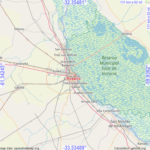
Rosario GPS coordinates[2]
32° 56' 48.552" South, 60° 38' 21.552" West
| Map corner | latitude | longitude |
|---|---|---|
| Upper-left | -32.35481°, | -61.34245° |
| Center: | -32.94682°, | -60.63932° |
| Lower-right: | -33.53489°, | -59.9362° |
| Map W x H: | 131.2×131.2 km | = 81.5×81.5mi |
| max Lat: | -21.94467° ⇑61.6% North |
| Rosario: | -32.94682° |
| min Lat: | ⇓38.4% South -54.81084° |
| min Long | Rosario | max Long |
| -72.88605° | -60.63932° | -53.64581° |
| W 63.6%⇐ | ⇒36.4% E |
Elevation
Elevation of Rosario is 38 m = 125 ft, and this is 311.3 m = 1021 ft below average elevation for this country.
| Max E: |
4040 m = 13255 ft | 86.4% |
| Avg. | 349.3 m = 1146 ft | |
| Rosario | 38 m = 125 ft | |
Min E: |
-2 m = -7 ft | 13.6% |
See also: Rosario elevation on elevation.city.
Geographical zone
Rosario is located in South temperate zone (between Tropic of Capricorn and the Antarctic Circle). Distance of this Southern Tropic circle is 1057.4 km =657 mi to North.| Distance of | km | miles | from Rosario |
|---|---|---|---|
| Equator | 3663.3 | 2276.3 | to North |
| Tropic Capricorn | 1057.4 | 657 | to North |
| Antarctic Circle | 3737.8 | 2322.6 | to South |
| South Pole | 6343.7 | 3941.8 | to South |


Nearby cities:
15 places around Rosario: (largest is in red/bold)
• Arroyo Seco
26.1 km =16.2 mi,  152°
152°
• Capitán Bermúdez
15.7 km =9.8 mi,  331°
331°
• Carcarañá
49 km =30.4 mi,  281°
281°
• Casilda
50.5 km =31.4 mi,  257°
257°
• Fray Luis A. Beltrán
19.2 km =11.9 mi, 334°
• Funes
16.3 km =10.1 mi, 282°
• Gobernador Gálvez
9.3 km =5.8 mi,  180°
180°
• Granadero Baigorria
12.4 km =7.7 mi,  323°
323°
• Pérez
13.3 km =8.3 mi,  244°
244°
• Roldán
25.5 km =15.8 mi, 282°
• San Lorenzo
24.4 km =15.2 mi,  338°
338°
• San Nicolás de los Arroyos
58.7 km =36.5 mi,  137°
137°
• Victoria
58.2 km =36.2 mi,  51°
51°
• Villa Constitución
42.5 km =26.4 mi, 137°
• Villa Mugueta
56 km =34.8 mi,  223°
223°
Sources, notices
• [Note1] Compared only with cities in Argentina existing in our database
• [Src1] Map data: © OpenStreetMap contributors (CC-BY-SA)
• [Src2] Other city data from geonames.org with taken over terms of usage.
• [Src3] Geographical zone / Annual Mean Temperature by Robert A. Rohde @ Wikipedia
