Roldán geodata
Roldán (Santa Fe) is a populated place; located in Argentina in America/Argentina/Cordoba (GMT-3) time zone. With population of 12,468 people, there are 252 cities with bigger population in this country. Compared to other cities in Argentina, 60.8% of cities are located further ↑North; 61.6% of cities are located further ←West and 85.7% of cities have higher elevation than Roldán. Note1


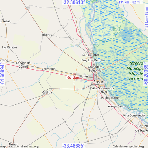
Roldán GPS coordinates[2]
32° 53' 54.456" South, 60° 54' 24.516" West
| Map corner | latitude | longitude |
|---|---|---|
| Upper-left | -32.30613°, | -61.60994° |
| Center: | -32.89846°, | -60.90681° |
| Lower-right: | -33.48685°, | -60.20369° |
| Map W x H: | 131.3×131.3 km | = 81.6×81.6mi |
| max Lat: | -21.94467° ⇑60.8% North |
| Roldán: | -32.89846° |
| min Lat: | ⇓39.2% South -54.81084° |
| min Long | Roldán | max Long |
| -72.88605° | -60.90681° | -53.64581° |
| W 61.6%⇐ | ⇒38.4% E |
Elevation
Elevation of Roldán is 43 m = 141 ft, and this is 306.3 m = 1005 ft below average elevation for this country.
| Max E: |
4040 m = 13255 ft | 85.7% |
| Avg. | 349.3 m = 1146 ft | |
| Roldán | 43 m = 141 ft | |
Min E: |
-2 m = -7 ft | 14.3% |
See also: Argentina elevation on elevation.city.
Geographical zone
Roldán is located in South temperate zone (between Tropic of Capricorn and the Antarctic Circle). Distance of this Southern Tropic circle is 1052 km =653.7 mi to North.| Distance of | km | miles | from Roldán |
|---|---|---|---|
| Equator | 3658 | 2273 | to North |
| Tropic Capricorn | 1052 | 653.7 | to North |
| Antarctic Circle | 3743.2 | 2325.9 | to South |
| South Pole | 6349.1 | 3945.1 | to South |


Nearby cities:
15 places around Roldán: (largest is in red/bold)
• Arroyo Seco
46.8 km =29.1 mi,  127°
127°
• Capitán Bermúdez
19.5 km =12.1 mi,  64°
64°
• Carcarañá
23.5 km =14.6 mi,  281°
281°
• Casilda
29.3 km =18.2 mi,  236°
236°
• Cañada de Gómez
46.5 km =28.9 mi, 281°
• Fray Luis A. Beltrán
20.5 km =12.7 mi,  54°
54°
• Funes
9.2 km =5.7 mi,  101°
101°
• Gobernador Gálvez
28.8 km =17.9 mi,  120°
120°
• Granadero Baigorria
18.3 km =11.4 mi,  75°
75°
• Las Parejas
61.7 km =38.3 mi,  292°
292°
• Pérez
17.1 km =10.6 mi, 130°
• Rosario
25.5 km =15.8 mi, 102°
• San Lorenzo
23.5 km =14.6 mi,  42°
42°
• Totoras
42.6 km =26.5 mi,  324°
324°
• Villa Mugueta
47.9 km =29.8 mi,  196°
196°
Sources, notices
• [Note1] Compared only with cities in Argentina existing in our database
• [Src1] Map data: © OpenStreetMap contributors (CC-BY-SA)
• [Src2] Other city data from geonames.org with taken over terms of usage.
• [Src3] Geographical zone / Annual Mean Temperature by Robert A. Rohde @ Wikipedia
