Ceres geodata
Ceres (Santa Fe) is a populated place; located in Argentina in America/Argentina/Cordoba (GMT-3) time zone. With population of 13,063 people, there are 245 cities with bigger population in this country. Compared to other cities in Argentina, 65.4% of cities are located further ↓South; 55.4% of cities are located further ←West and 66.6% of cities have higher elevation than Ceres. Note1


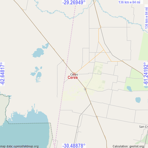
Ceres GPS coordinates[2]
29° 52' 51.6" South, 61° 56' 42.144" West
| Map corner | latitude | longitude |
|---|---|---|
| Upper-left | -29.26949°, | -62.64817° |
| Center: | -29.881°, | -61.94504° |
| Lower-right: | -30.48878°, | -61.24192° |
| Map W x H: | 135.6×135.6 km | = 84.3×84.3mi |
| max Lat: | -21.94467° ⇑34.6% North |
| Ceres: | -29.881° |
| min Lat: | ⇓65.4% South -54.81084° |
| min Long | Ceres | max Long |
| -72.88605° | -61.94504° | -53.64581° |
| W 55.4%⇐ | ⇒44.6% E |
Elevation
Elevation of Ceres is 90 m = 295 ft, and this is 259.3 m = 851 ft below average elevation for this country.
| Max E: |
4040 m = 13255 ft | 66.6% |
| Avg. | 349.3 m = 1146 ft | |
| Ceres | 90 m = 295 ft | |
Min E: |
-2 m = -7 ft | 33.4% |
See also: Argentina elevation on elevation.city.
Geographical zone
Ceres is located in South temperate zone (between Tropic of Capricorn and the Antarctic Circle). Distance of this Southern Tropic circle is 716.5 km =445.2 mi to North.| Distance of | km | miles | from Ceres |
|---|---|---|---|
| Equator | 3322.5 | 2064.5 | to North |
| Tropic Capricorn | 716.5 | 445.2 | to North |
| Antarctic Circle | 4078.7 | 2534.4 | to South |
| South Pole | 6684.6 | 4153.6 | to South |


Nearby cities:
15 places around Ceres: (largest is in red/bold)
• Altos de Chipión
125.3 km =77.9 mi,  197°
197°
• Arrufó
44.3 km =27.5 mi,  151°
151°
• Bandera
114.7 km =71.3 mi,  344°
344°
• Brinkmann
109.9 km =68.3 mi,  184°
184°
• Hersilia
17 km =10.6 mi,  143°
143°
• Miramar
135.1 km =83.9 mi,  211°
211°
• Morteros
92.5 km =57.5 mi, 183°
• Porteña
126.5 km =78.6 mi,  185°
185°
• San Cristóbal
83.2 km =51.7 mi,  125°
125°
• Selva
16 km =9.9 mi,  321°
321°
• Sunchales
123.8 km =76.9 mi,  162°
162°
• Tostado
74.1 km =46 mi,  13°
13°
• Villa General Mitre
106.9 km =66.4 mi, 320°
• Villa Trinidad
37.5 km =23.3 mi,  169°
169°
• Villa Unión
96.6 km =60 mi,  302°
302°
Sources, notices
• [Note1] Compared only with cities in Argentina existing in our database
• [Src1] Map data: © OpenStreetMap contributors (CC-BY-SA)
• [Src2] Other city data from geonames.org with taken over terms of usage.
• [Src3] Geographical zone / Annual Mean Temperature by Robert A. Rohde @ Wikipedia
