Hersilia geodata
Hersilia (Santa Fe) is a populated place; located in Argentina in America/Argentina/Cordoba (GMT-3) time zone. With population of 3,000 people, there are 550 cities with bigger population in this country. Compared to other cities in Argentina, 65.1% of cities are located further ↓South; 56.2% of cities are located further ←West and 65.3% of cities have higher elevation than Hersilia. Note1


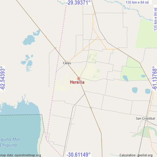
Hersilia GPS coordinates[2]
30° 0' 16.092" South, 61° 50' 26.88" West
| Map corner | latitude | longitude |
|---|---|---|
| Upper-left | -29.39371°, | -62.54393° |
| Center: | -30.00447°, | -61.8408° |
| Lower-right: | -30.61149°, | -61.13768° |
| Map W x H: | 135.4×135.4 km | = 84.1×84.1mi |
| max Lat: | -21.94467° ⇑34.9% North |
| Hersilia: | -30.00447° |
| min Lat: | ⇓65.1% South -54.81084° |
| min Long | Hersilia | max Long |
| -72.88605° | -61.8408° | -53.64581° |
| W 56.2%⇐ | ⇒43.8% E |
Elevation
Elevation of Hersilia is 93 m = 305 ft, and this is 256.3 m = 841 ft below average elevation for this country.
| Max E: |
4040 m = 13255 ft | 65.3% |
| Avg. | 349.3 m = 1146 ft | |
| Hersilia | 93 m = 305 ft | |
Min E: |
-2 m = -7 ft | 34.7% |
See also: Argentina elevation on elevation.city.
Geographical zone
Hersilia is located in South temperate zone (between Tropic of Capricorn and the Antarctic Circle). Distance of this Southern Tropic circle is 730.3 km =453.8 mi to North.| Distance of | km | miles | from Hersilia |
|---|---|---|---|
| Equator | 3336.2 | 2073 | to North |
| Tropic Capricorn | 730.3 | 453.8 | to North |
| Antarctic Circle | 4065 | 2525.9 | to South |
| South Pole | 6670.9 | 4145.1 | to South |


Nearby cities:
15 places around Hersilia: (largest is in red/bold)
• Altos de Chipión
116 km =72.1 mi,  204°
204°
• Arrufó
27.6 km =17.1 mi,  156°
156°
• Bandera
130.7 km =81.2 mi,  341°
341°
• Brinkmann
97.6 km =60.6 mi,  191°
191°
• Ceres
17 km =10.6 mi,  323°
323°
• Miramar
129.5 km =80.5 mi,  218°
218°
• Morteros
80.1 km =49.8 mi, 190°
• Porteña
114.3 km =71 mi, 190°
• San Cristóbal
67.3 km =41.8 mi,  120°
120°
• Selva
33 km =20.5 mi, 322°
• Sunchales
107.8 km =67 mi,  165°
165°
• Tostado
86.2 km =53.6 mi,  4°
4°
• Villa General Mitre
123.8 km =76.9 mi, 320°
• Villa Trinidad
23.5 km =14.6 mi, 188°
• Villa Unión
112.6 km =70 mi,  305°
305°
Sources, notices
• [Note1] Compared only with cities in Argentina existing in our database
• [Src1] Map data: © OpenStreetMap contributors (CC-BY-SA)
• [Src2] Other city data from geonames.org with taken over terms of usage.
• [Src3] Geographical zone / Annual Mean Temperature by Robert A. Rohde @ Wikipedia
