Villa Cañás geodata
Villa Cañás (Santa Fe) is a populated place; located in Argentina in America/Argentina/Cordoba (GMT-3) time zone. With population of 9,328 people, there are 305 cities with bigger population in this country. Compared to other cities in Argentina, 68.8% of cities are located further ↑North; 57.2% of cities are located further ←West and 61.3% of cities have higher elevation than Villa Cañás. Note1


Villa Cañás GPS coordinates[2]
34° 0' 20.34" South, 61° 36' 27.252" West
| Map corner | latitude | longitude |
|---|---|---|
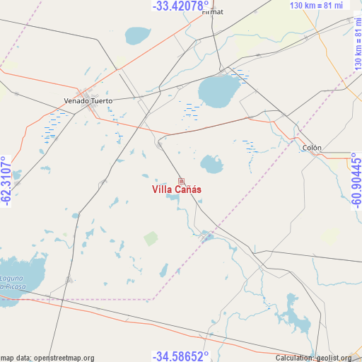
| Upper-left | -33.42078°, | -62.3107° |
| Center: | -34.00565°, | -61.60757° |
| Lower-right: | -34.58652°, | -60.90445° |
| Map W x H: | 129.6×129.6 km | = 80.5×80.5mi |
| max Lat: | -21.94467° ⇑68.8% North |
| Villa Cañás: | -34.00565° |
| min Lat: | ⇓31.2% South -54.81084° |
| min Long | Villa Cañás | max Long |
| -72.88605° | -61.60757° | -53.64581° |
| W 57.2%⇐ | ⇒42.8% E |
Elevation
Elevation of Villa Cañás is 104 m = 341 ft, and this is 245.3 m = 805 ft below average elevation for this country.
| Max E: |
4040 m = 13255 ft | 61.3% |
| Avg. | 349.3 m = 1146 ft | |
| Villa Cañás | 104 m = 341 ft | |
Min E: |
-2 m = -7 ft | 38.7% |
See also: Argentina elevation on elevation.city.
Geographical zone
Villa Cañás is located in South temperate zone (between Tropic of Capricorn and the Antarctic Circle). Distance of this Southern Tropic circle is 1175.2 km =730.2 mi to North.| Distance of | km | miles | from Villa Cañás |
|---|---|---|---|
| Equator | 3781.1 | 2349.5 | to North |
| Tropic Capricorn | 1175.2 | 730.2 | to North |
| Antarctic Circle | 3620.1 | 2249.4 | to South |
| South Pole | 6226 | 3868.7 | to South |


Nearby cities:
15 places around Villa Cañás: (largest is in red/bold)
• Arias
83.7 km =52 mi,  298°
298°
• Cavanagh
89.7 km =55.7 mi,  311°
311°
• Chañar Ladeado
85.5 km =53.1 mi,  332°
332°
• Colón
48.3 km =30 mi,  75°
75°
• Firmat
61.8 km =38.4 mi,  10°
10°
• General Arenales
43.2 km =26.8 mi,  139°
139°
• General Pinto
88.3 km =54.9 mi,  197°
197°
• Junín
88.6 km =55.1 mi, 136°
• Lincoln
96 km =59.7 mi,  175°
175°
• Melincué
41.1 km =25.5 mi,  20°
20°
• Pergamino
96.2 km =59.8 mi, 82°
• Rojas
83.1 km =51.6 mi,  104°
104°
• Vedia
54.8 km =34.1 mi,  173°
173°
• Venado Tuerto
44.1 km =27.4 mi, 310°
• Villa Mugueta
92.6 km =57.5 mi,  33°
33°
Sources, notices
• [Note1] Compared only with cities in Argentina existing in our database
• [Src1] Map data: © OpenStreetMap contributors (CC-BY-SA)
• [Src2] Other city data from geonames.org with taken over terms of usage.
• [Src3] Geographical zone / Annual Mean Temperature by Robert A. Rohde @ Wikipedia
