General Pinto geodata
General Pinto (Buenos Aires) is a seat of a second-order administrative division; located in Argentina in America/Argentina/Buenos_Aires (GMT-3) time zone. In our database, there are 785 cities with bigger population. Compared to other cities in Argentina, 75.5% of cities are located further ↑North; 55.8% of cities are located further ←West and 62.3% of cities have higher elevation than General Pinto. Note1


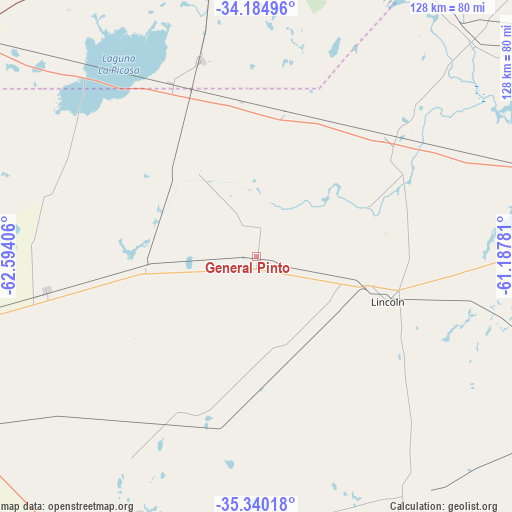
General Pinto GPS coordinates[2]
34° 45' 52.524" South, 61° 53' 27.348" West
| Map corner | latitude | longitude |
|---|---|---|
| Upper-left | -34.18496°, | -62.59406° |
| Center: | -34.76459°, | -61.89093° |
| Lower-right: | -35.34018°, | -61.18781° |
| Map W x H: | 128.4×128.4 km | = 79.8×79.8mi |
| max Lat: | -21.94467° ⇑75.5% North |
| General Pinto: | -34.76459° |
| min Lat: | ⇓24.5% South -54.81084° |
| min Long | General Pinto | max Long |
| -72.88605° | -61.89093° | -53.64581° |
| W 55.8%⇐ | ⇒44.2% E |
Elevation
Elevation of General Pinto is 101 m = 331 ft, and this is 248.3 m = 815 ft below average elevation for this country.
| Max E: |
4040 m = 13255 ft | 62.3% |
| Avg. | 349.3 m = 1146 ft | |
| General Pinto | 101 m = 331 ft | |
Min E: |
-2 m = -7 ft | 37.7% |
See also: Argentina elevation on elevation.city.
Geographical zone
General Pinto is located in South temperate zone (between Tropic of Capricorn and the Antarctic Circle). Distance of this Southern Tropic circle is 1259.5 km =782.6 mi to North.| Distance of | km | miles | from General Pinto |
|---|---|---|---|
| Equator | 3865.5 | 2401.9 | to North |
| Tropic Capricorn | 1259.5 | 782.6 | to North |
| Antarctic Circle | 3535.7 | 2197 | to South |
| South Pole | 6141.6 | 3816.2 | to South |


Nearby cities:
15 places around General Pinto: (largest is in red/bold)
• Carlos Casares
106.7 km =66.3 mi,  153°
153°
• Carlos Tejedor
84.9 km =52.8 mi,  214°
214°
• Florentino Ameghino
53.3 km =33.1 mi,  260°
260°
• General Arenales
74.3 km =46.2 mi,  46°
46°
• General Viamonte
82.3 km =51.1 mi,  108°
108°
• General Villegas
106.5 km =66.2 mi,  253°
253°
• Junín
89 km =55.3 mi,  76°
76°
• Lincoln
34.8 km =21.6 mi, 108°
• Nueve de Julio
118.8 km =73.8 mi,  129°
129°
• Pehuajó
116.3 km =72.3 mi,  180°
180°
• Rufino
93.3 km =58 mi,  306°
306°
• Tres Algarrobos
93.6 km =58.2 mi,  239°
239°
• Vedia
43.8 km =27.2 mi, 46°
• Venado Tuerto
113.5 km =70.5 mi,  356°
356°
• Villa Cañás
88.3 km =54.9 mi,  17°
17°
Sources, notices
• [Note1] Compared only with cities in Argentina existing in our database
• [Src1] Map data: © OpenStreetMap contributors (CC-BY-SA)
• [Src2] Other city data from geonames.org with taken over terms of usage.
• [Src3] Geographical zone / Annual Mean Temperature by Robert A. Rohde @ Wikipedia
