Santa Isabel geodata
Santa Isabel (La Pampa) is a seat of a second-order administrative division; located in Argentina in America/Argentina/Salta (GMT-3) time zone. With population of 2,493 people, there are 592 cities with bigger population in this country. Compared to other cities in Argentina, 82.2% of cities are located further ↑North; 85.9% of cities are located further →East and 68.2% of cities have lower elevation than Santa Isabel. Note1


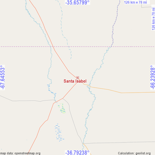
Santa Isabel GPS coordinates[2]
36° 13' 38.064" South, 66° 56' 32.64" West
| Map corner | latitude | longitude |
|---|---|---|
| Upper-left | -35.65799°, | -67.64553° |
| Center: | -36.22724°, | -66.9424° |
| Lower-right: | -36.79238°, | -66.23928° |
| Map W x H: | 126.1×126.1 km | = 78.4×78.4mi |
| max Lat: | -21.94467° ⇑82.2% North |
| Santa Isabel: | -36.22724° |
| min Lat: | ⇓17.8% South -54.81084° |
| min Long | Santa Isabel | max Long |
| -72.88605° | -66.9424° | -53.64581° |
| W 14.1%⇐ | ⇒85.9% E |
Elevation
Elevation of Santa Isabel is 315 m = 1033 ft, and this is 34.3 m = 113 ft below average elevation for this country.
| Max E: |
4040 m = 13255 ft | 31.8% |
| Avg. | 349.3 m = 1146 ft | |
| Santa Isabel | 315 m = 1033 ft | |
Min E: |
-2 m = -7 ft | 68.2% |
See also: Argentina elevation on elevation.city.
Geographical zone
Santa Isabel is located in South temperate zone (between Tropic of Capricorn and the Antarctic Circle). Distance of this Southern Tropic circle is 1422.2 km =883.7 mi to North.| Distance of | km | miles | from Santa Isabel |
|---|---|---|---|
| Equator | 4028.1 | 2502.9 | to North |
| Tropic Capricorn | 1422.2 | 883.7 | to North |
| Antarctic Circle | 3373.1 | 2095.9 | to South |
| South Pole | 5979 | 3715.2 | to South |


Nearby cities:
15 places around Santa Isabel: (largest is in red/bold)
• Algarrobo del Águila
26.4 km =16.4 mi,  223°
223°
• Buena Esperanza
223.9 km =139.1 mi,  43°
43°
• Caleufú
225.9 km =140.4 mi,  71°
71°
• Catriel
198.7 km =123.5 mi,  202°
202°
• General Alvear
154.6 km =96.1 mi,  334°
334°
• La Humada
97 km =60.3 mi,  261°
261°
• La Maruja
190.5 km =118.4 mi, 71°
• Limay Mahuida
106.4 km =66.1 mi,  167°
167°
• Puelches
231.9 km =144.1 mi,  156°
156°
• Rincón de Los Sauces
219.6 km =136.5 mi,  233°
233°
• San Rafael
218.7 km =135.9 mi,  324°
324°
• Telén
128.5 km =79.8 mi,  91°
91°
• Unión
149.6 km =93 mi, 36°
• Veinticinco de Mayo
185.2 km =115.1 mi, 201°
• Victorica
135.1 km =83.9 mi, 89°
Sources, notices
• [Note1] Compared only with cities in Argentina existing in our database
• [Src1] Map data: © OpenStreetMap contributors (CC-BY-SA)
• [Src2] Other city data from geonames.org with taken over terms of usage.
• [Src3] Geographical zone / Annual Mean Temperature by Robert A. Rohde @ Wikipedia
