General Alvear geodata
General Alvear (Mendoza) is a seat of a second-order administrative division; located in Argentina in America/Argentina/Mendoza (GMT-3) time zone. In our database, there are 785 cities with bigger population. Compared to other cities in Argentina, 77.3% of cities are located further ↑North; 88.5% of cities are located further →East and 76.5% of cities have lower elevation than General Alvear. Note1


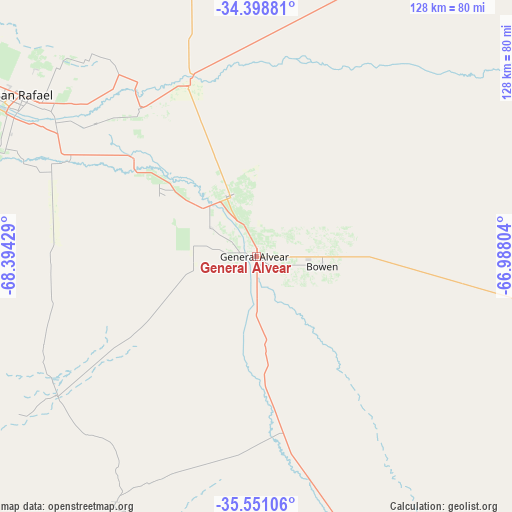
General Alvear GPS coordinates[2]
34° 58' 37.056" South, 67° 41' 28.176" West
| Map corner | latitude | longitude |
|---|---|---|
| Upper-left | -34.39881°, | -68.39429° |
| Center: | -34.97696°, | -67.69116° |
| Lower-right: | -35.55106°, | -66.98804° |
| Map W x H: | 128.1×128.1 km | = 79.6×79.6mi |
| max Lat: | -21.94467° ⇑77.3% North |
| General Alvear: | -34.97696° |
| min Lat: | ⇓22.7% South -54.81084° |
| min Long | General Alvear | max Long |
| -72.88605° | -67.69116° | -53.64581° |
| W 11.5%⇐ | ⇒88.5% E |
Elevation
Elevation of General Alvear is 478 m = 1568 ft, and this is 128.7 m = 422 ft above average elevation for this country.
| Max E: |
4040 m = 13255 ft | 23.5% |
| General Alvear | 478 m 1568 ft | |
| Avg. | 349.3 m = 1146 ft | |
Min E: |
-2 m = -7 ft | 76.5% |
See also: Argentina elevation on elevation.city.
Geographical zone
General Alvear is located in South temperate zone (between Tropic of Capricorn and the Antarctic Circle). Distance of this Southern Tropic circle is 1283.2 km =797.3 mi to North.| Distance of | km | miles | from General Alvear |
|---|---|---|---|
| Equator | 3889.1 | 2416.6 | to North |
| Tropic Capricorn | 1283.2 | 797.3 | to North |
| Antarctic Circle | 3512.1 | 2182.3 | to South |
| South Pole | 6118 | 3801.5 | to South |


Nearby cities:
15 places around General Alvear: (largest is in red/bold)
• Algarrobo del Águila
165.7 km =103 mi,  162°
162°
• Buena Esperanza
223.7 km =139 mi,  83°
83°
• Junín
216 km =134.2 mi,  340°
340°
• La Consulta
190.5 km =118.4 mi,  316°
316°
• La Humada
155.3 km =96.5 mi,  190°
190°
• La Paz
169.1 km =105.1 mi,  4°
4°
• Malargüe
180.7 km =112.3 mi,  252°
252°
• Rivadavia
210.9 km =131 mi, 340°
• San Martín
222.6 km =138.3 mi, 341°
• San Rafael
70.7 km =43.9 mi,  304°
304°
• Santa Isabel
154.6 km =96.1 mi,  154°
154°
• Santa Rosa
196.2 km =121.9 mi,  347°
347°
• Tunuyán
197.6 km =122.8 mi, 321°
• Tupungato
223.2 km =138.7 mi, 323°
• Unión
160 km =99.4 mi,  97°
97°
Sources, notices
• [Note1] Compared only with cities in Argentina existing in our database
• [Src1] Map data: © OpenStreetMap contributors (CC-BY-SA)
• [Src2] Other city data from geonames.org with taken over terms of usage.
• [Src3] Geographical zone / Annual Mean Temperature by Robert A. Rohde @ Wikipedia
