Alejo Ledesma geodata
Alejo Ledesma (Cordoba) is a populated place; located in Argentina in America/Argentina/Cordoba (GMT-3) time zone. With population of 3,310 people, there are 534 cities with bigger population in this country. Compared to other cities in Argentina, 66.9% of cities are located further ↑North; 51.7% of cities are located further ←West and 52.2% of cities have higher elevation than Alejo Ledesma. Note1


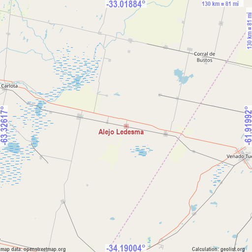
Alejo Ledesma GPS coordinates[2]
33° 36' 23.148" South, 62° 37' 22.944" West
| Map corner | latitude | longitude |
|---|---|---|
| Upper-left | -33.01884°, | -63.32617° |
| Center: | -33.60643°, | -62.62304° |
| Lower-right: | -34.19004°, | -61.91992° |
| Map W x H: | 130.2×130.2 km | = 80.9×80.9mi |
| max Lat: | -21.94467° ⇑66.9% North |
| Alejo Ledesma: | -33.60643° |
| min Lat: | ⇓33.1% South -54.81084° |
| min Long | Alejo Ledesma | max Long |
| -72.88605° | -62.62304° | -53.64581° |
| W 51.7%⇐ | ⇒48.3% E |
Elevation
Elevation of Alejo Ledesma is 132 m = 433 ft, and this is 217.3 m = 713 ft below average elevation for this country.
| Max E: |
4040 m = 13255 ft | 52.2% |
| Avg. | 349.3 m = 1146 ft | |
| Alejo Ledesma | 132 m = 433 ft | |
Min E: |
-2 m = -7 ft | 47.8% |
See also: Argentina elevation on elevation.city.
Geographical zone
Alejo Ledesma is located in South temperate zone (between Tropic of Capricorn and the Antarctic Circle). Distance of this Southern Tropic circle is 1130.8 km =702.6 mi to North.| Distance of | km | miles | from Alejo Ledesma |
|---|---|---|---|
| Equator | 3736.7 | 2321.9 | to North |
| Tropic Capricorn | 1130.8 | 702.6 | to North |
| Antarctic Circle | 3664.5 | 2277 | to South |
| South Pole | 6270.4 | 3896.2 | to South |


Nearby cities:
15 places around Alejo Ledesma: (largest is in red/bold)
• Arias
20.8 km =12.9 mi,  101°
101°
• Canals
25.1 km =15.6 mi,  280°
280°
• Cavanagh
30.1 km =18.7 mi,  61°
61°
• Chañar Ladeado
62.6 km =38.9 mi, 60°
• Corral de Bustos
54.4 km =33.8 mi,  48°
48°
• General Baldissera
61.3 km =38.1 mi,  28°
28°
• Guatimozín
23.5 km =14.6 mi, 46°
• Isla Verde
45.5 km =28.3 mi, 26°
• La Carlota
65.9 km =40.9 mi,  288°
288°
• La Cesira
50.1 km =31.1 mi,  220°
220°
• Laborde
54.9 km =34.1 mi,  336°
336°
• Monte Maíz
44.7 km =27.8 mi,  2°
2°
• Venado Tuerto
62.5 km =38.8 mi, 104°
• Viamonte
46.6 km =29 mi,  250°
250°
• Wenceslao Escalante
50.1 km =31.1 mi, 344°
Sources, notices
• [Note1] Compared only with cities in Argentina existing in our database
• [Src1] Map data: © OpenStreetMap contributors (CC-BY-SA)
• [Src2] Other city data from geonames.org with taken over terms of usage.
• [Src3] Geographical zone / Annual Mean Temperature by Robert A. Rohde @ Wikipedia
