General La Madrid geodata
General La Madrid (Buenos Aires) is a seat of a second-order administrative division; located in Argentina in America/Argentina/Buenos_Aires (GMT-3) time zone. In our database, there are 785 cities with bigger population. Compared to other cities in Argentina, 86.4% of cities are located further ↑North; 59.3% of cities are located further ←West and 54.9% of cities have lower elevation than General La Madrid. Note1


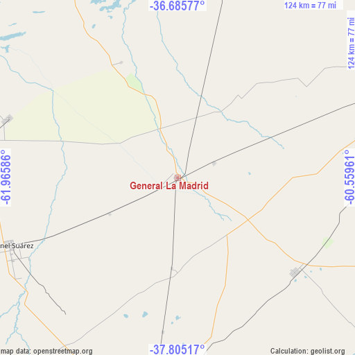
General La Madrid GPS coordinates[2]
37° 14' 51.18" South, 61° 15' 45.828" West
| Map corner | latitude | longitude |
|---|---|---|
| Upper-left | -36.68577°, | -61.96586° |
| Center: | -37.24755°, | -61.26273° |
| Lower-right: | -37.80517°, | -60.55961° |
| Map W x H: | 124.5×124.5 km | = 77.4×77.4mi |
| max Lat: | -21.94467° ⇑86.4% North |
| General La Madrid: | -37.24755° |
| min Lat: | ⇓13.6% South -54.81084° |
| min Long | General La Madr | max Long |
| -72.88605° | -61.26273° | -53.64581° |
| W 59.3%⇐ | ⇒40.7% E |
Elevation
Elevation of General La Madrid is 172 m = 564 ft, and this is 177.3 m = 582 ft below average elevation for this country.
| Max E: |
4040 m = 13255 ft | 45.1% |
| Avg. | 349.3 m = 1146 ft | |
| General La Madrid | 172 m = 564 ft | |
Min E: |
-2 m = -7 ft | 54.9% |
See also: Argentina elevation on elevation.city.
Geographical zone
General La Madrid is located in South temperate zone (between Tropic of Capricorn and the Antarctic Circle). Distance of this Southern Tropic circle is 1535.6 km =954.2 mi to North.| Distance of | km | miles | from General La Madrid |
|---|---|---|---|
| Equator | 4141.5 | 2573.4 | to North |
| Tropic Capricorn | 1535.6 | 954.2 | to North |
| Antarctic Circle | 3259.6 | 2025.4 | to South |
| South Pole | 5865.5 | 3644.7 | to South |


Nearby cities:
15 places around General La Madrid: (largest is in red/bold)
• Azul
135.2 km =84 mi,  67°
67°
• Benito Juárez
136.9 km =85.1 mi,  110°
110°
• Carhué
132.6 km =82.4 mi,  273°
273°
• Coronel Pringles
82.2 km =51.1 mi,  185°
185°
• Coronel Suárez
63.6 km =39.5 mi,  248°
248°
• Daireaux
84 km =52.2 mi,  328°
328°
• Guaminí
105.7 km =65.7 mi,  284°
284°
• Henderson
112.8 km =70.1 mi,  339°
339°
• Laprida
52.5 km =32.6 mi,  128°
128°
• Olavarría
92.3 km =57.4 mi,  64°
64°
• Pigüé
108.3 km =67.3 mi, 248°
• Puan
137 km =85.1 mi,  255°
255°
• San Carlos de Bolívar
113.8 km =70.7 mi,  6°
6°
• Tapalqué
148.2 km =92.1 mi,  47°
47°
• Tornquist
127.1 km =79 mi,  221°
221°
Sources, notices
• [Note1] Compared only with cities in Argentina existing in our database
• [Src1] Map data: © OpenStreetMap contributors (CC-BY-SA)
• [Src2] Other city data from geonames.org with taken over terms of usage.
• [Src3] Geographical zone / Annual Mean Temperature by Robert A. Rohde @ Wikipedia
