Olavarría geodata
Olavarría (Buenos Aires) is a seat of a second-order administrative division; located in Argentina in America/Argentina/Buenos_Aires (GMT-3) time zone. With population of 86,320 people, there are 47 cities with bigger population in this country. Compared to other cities in Argentina, 85% of cities are located further ↑North; 65.7% of cities are located further ←West and 54.6% of cities have lower elevation than Olavarría. Note1


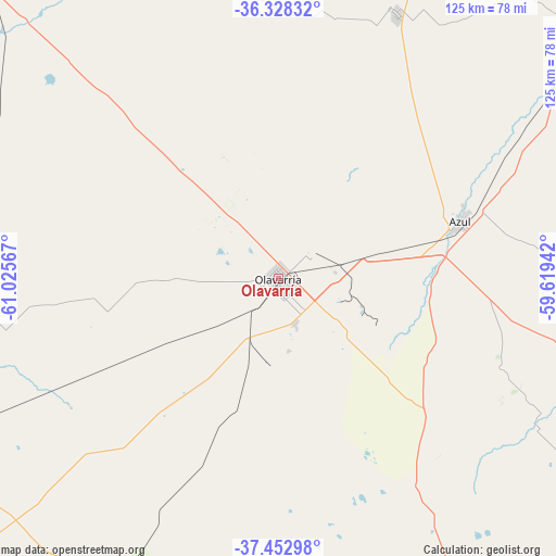
Olavarría GPS coordinates[2]
36° 53' 33.792" South, 60° 19' 21.144" West
| Map corner | latitude | longitude |
|---|---|---|
| Upper-left | -36.32832°, | -61.02567° |
| Center: | -36.89272°, | -60.32254° |
| Lower-right: | -37.45298°, | -59.61942° |
| Map W x H: | 125.1×125 km | = 77.7×77.7mi |
| max Lat: | -21.94467° ⇑85% North |
| Olavarría: | -36.89272° |
| min Lat: | ⇓15% South -54.81084° |
| min Long | Olavarría | max Long |
| -72.88605° | -60.32254° | -53.64581° |
| W 65.7%⇐ | ⇒34.3% E |
Elevation
Elevation of Olavarría is 170 m = 558 ft, and this is 179.3 m = 588 ft below average elevation for this country.
| Max E: |
4040 m = 13255 ft | 45.4% |
| Avg. | 349.3 m = 1146 ft | |
| Olavarría | 170 m = 558 ft | |
Min E: |
-2 m = -7 ft | 54.6% |
See also: Olavarría elevation on elevation.city.
Geographical zone
Olavarría is located in South temperate zone (between Tropic of Capricorn and the Antarctic Circle). Distance of this Southern Tropic circle is 1496.2 km =929.7 mi to North.| Distance of | km | miles | from Olavarría |
|---|---|---|---|
| Equator | 4102.1 | 2548.9 | to North |
| Tropic Capricorn | 1496.2 | 929.7 | to North |
| Antarctic Circle | 3299.1 | 2050 | to South |
| South Pole | 5905 | 3669.2 | to South |


Nearby cities:
15 places around Olavarría: (largest is in red/bold)
• Azul
43.3 km =26.9 mi,  72°
72°
• Benito Juárez
97.9 km =60.8 mi,  152°
152°
• Coronel Pringles
151.7 km =94.3 mi,  216°
216°
• Coronel Suárez
155.8 km =96.8 mi,  246°
246°
• Daireaux
131.3 km =81.6 mi,  284°
284°
• General Alvear
100.8 km =62.6 mi,  15°
15°
• General La Madrid
92.3 km =57.4 mi,  244°
244°
• Henderson
140.8 km =87.5 mi,  297°
297°
• Laprida
83.9 km =52.1 mi,  210°
210°
• Las Flores
146.6 km =91.1 mi,  48°
48°
• Rauch
110.5 km =68.7 mi,  83°
83°
• Saladillo
147.9 km =91.9 mi, 19°
• San Carlos de Bolívar
102.2 km =63.5 mi,  316°
316°
• Tandil
115.7 km =71.9 mi,  114°
114°
• Tapalqué
65.4 km =40.6 mi, 23°
Sources, notices
• [Note1] Compared only with cities in Argentina existing in our database
• [Src1] Map data: © OpenStreetMap contributors (CC-BY-SA)
• [Src2] Other city data from geonames.org with taken over terms of usage.
• [Src3] Geographical zone / Annual Mean Temperature by Robert A. Rohde @ Wikipedia
