Carhué geodata
Carhué (Buenos Aires) is a seat of a second-order administrative division; located in Argentina in America/Argentina/Buenos_Aires (GMT-3) time zone. In our database, there are 785 cities with bigger population. Compared to other cities in Argentina, 86.2% of cities are located further ↑North; 50.2% of cities are located further ←West and 59.2% of cities have higher elevation than Carhué. Note1


Carhué GPS coordinates[2]
37° 10' 36.048" South, 62° 45' 28.512" West
| Map corner | latitude | longitude |
|---|---|---|
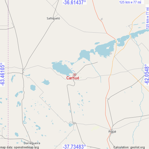
| Upper-left | -36.61437°, | -63.46105° |
| Center: | -37.17668°, | -62.75792° |
| Lower-right: | -37.73483°, | -62.0548° |
| Map W x H: | 124.6×124.6 km | = 77.4×77.4mi |
| max Lat: | -21.94467° ⇑86.2% North |
| Carhué: | -37.17668° |
| min Lat: | ⇓13.8% South -54.81084° |
| min Long | Carhué | max Long |
| -72.88605° | -62.75792° | -53.64581° |
| W 50.2%⇐ | ⇒49.8% E |
Elevation
Elevation of Carhué is 110 m = 361 ft, and this is 239.3 m = 785 ft below average elevation for this country.
| Max E: |
4040 m = 13255 ft | 59.2% |
| Avg. | 349.3 m = 1146 ft | |
| Carhué | 110 m = 361 ft | |
Min E: |
-2 m = -7 ft | 40.8% |
See also: Argentina elevation on elevation.city.
Geographical zone
Carhué is located in South temperate zone (between Tropic of Capricorn and the Antarctic Circle). Distance of this Southern Tropic circle is 1527.7 km =949.3 mi to North.| Distance of | km | miles | from Carhué |
|---|---|---|---|
| Equator | 4133.7 | 2568.6 | to North |
| Tropic Capricorn | 1527.7 | 949.3 | to North |
| Antarctic Circle | 3267.5 | 2030.3 | to South |
| South Pole | 5873.4 | 3649.6 | to South |


Nearby cities:
15 places around Carhué: (largest is in red/bold)
• Alpachiri
92.7 km =57.6 mi,  256°
256°
• Catriló
104.1 km =64.7 mi,  325°
325°
• Coronel Suárez
79.2 km =49.2 mi,  112°
112°
• Daireaux
110.2 km =68.5 mi,  54°
54°
• General Manuel J. Campos
79.7 km =49.5 mi,  246°
246°
• Guaminí
35.1 km =21.8 mi,  58°
58°
• Guatraché
87.4 km =54.3 mi,  231°
231°
• Lonquimay
110.5 km =68.7 mi,  315°
315°
• Macachín
80.6 km =50.1 mi,  273°
273°
• Miguel Riglos
90.1 km =56 mi,  293°
293°
• Pellegrini
107.6 km =66.9 mi,  340°
340°
• Pigüé
57 km =35.4 mi,  146°
146°
• Puan
41 km =25.5 mi,  181°
181°
• Salliqueló
50.5 km =31.4 mi, 339°
• Tres Lomas
80.5 km =50 mi,  353°
353°
Sources, notices
• [Note1] Compared only with cities in Argentina existing in our database
• [Src1] Map data: © OpenStreetMap contributors (CC-BY-SA)
• [Src2] Other city data from geonames.org with taken over terms of usage.
• [Src3] Geographical zone / Annual Mean Temperature by Robert A. Rohde @ Wikipedia
